
Added GEOLOGIC MAP CHICKASAW NATIONAL REC, OK to cart. View cart.
GEOLOGIC FRAMEWORK AND HYDROSTRATIGRAPHY

Product Details
- Product Number
- 527722
- Series
- SIM-3418
- Scale
- NO SCALE
- Alternate ID
- SIM-3418
- ISBN
- 978-1-4113-4262-0
- Authors
- ALLAN K CLARK
- Version Date
- 01/01/2018
- Countries
- USA
- Media
- Paper
- Format
- Bound
Additional Details
- Description
-
First posted October 9, 2018
For additional information, contact:
Director, Texas Water Science Center U.S. Geological Survey 505 Ferguson Lane Austin, Texas 78754–4501
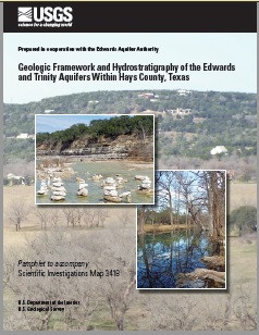
Abstract
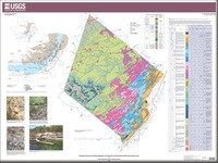
The Edwards and Trinity aquifers are classified as major aquifers by the Texas Water Development Board and are major sources of water in south-central Texas, where Hays County is located. Detailed maps and descriptions of the geologic framework and hydrostratigraphic units (HSUs) of these karstic aquifers in Hays County are needed for water managers to effectively manage groundwater resources in the area. During 2016–18, the U.S. Geological Survey, in cooperation with the Edwards Aquifer Authority, documented the geologic framework and hydrostratigraphy of the Edwards and Trinity aquifers for a large part of Hays County, characterizing approximately 560 square miles of the county. The report includes a 1:24,000-scale hydrostratigraphic map and descriptions of the geology and HSUs in the study area. In addition, parts of the adjacent upper confining unit to the Edwards aquifer are described.
The rocks exposed within the study area are within outcrops of the Trinity and Edwards Groups and the overlying Washita, Eagle Ford, Austin, and Taylor Groups. The rocks are sedimentary and formed during the Cretaceous age. The principal structural feature in Hays County is the Balcones fault zone, which is the result of late Oligocene and early Miocene age high-angle normal faulting and fracturing. Hydrostratigraphically, the exposed rocks represent a section of the upper confining unit to the Edwards aquifer, the Edwards aquifer, the upper zone of the Trinity aquifer, the middle zone of the Trinity aquifer, and the upper part of the lower zone of the Trinity aquifer. Complexity in the aquifer system results from a combination of the original depositional history, bioturbation, primary and secondary porosity, diagenesis, fracturing, and faulting.
- Print Date
- 2018
- Height In Inches
- 28.000
- Length In Inches
- 32.000
- Two Sided
- Yes
- Pieces
- 2
- Languages
- English


