Product

GREAT DISMAL SWAMP, VA IMPLICATIONS FOR

$16.00
Available

Product Details

Product Number
534320
Series
SIR 2020-5100
Scale
NO SCALE
Alternate ID
SIR-2020-5100
ISBN
978-1-4113-4518-8
Authors
FREDERIC C WURSTER
Version Date
01/01/2020
Regions
NC, VA
Countries
USA
Media
Paper
Format
Bound

Additional Details

Description
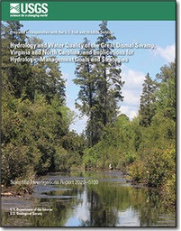
Hydrology and Water Quality of the Great Dismal Swamp, Virginia and North Carolina, and Implications for Hydrologic-Management Goals and Strategies

Scientific Investigations Report 2020-5100

Prepared in cooperation with the U.S. Fish and Wildlife Service

By: Gary K. Speiran and Frederic C. Wurster

https://doi.org/10.3133/sir20205100

First posted October 21, 2021

For additional information, contact:

Center Director,

dc_va@usgs.gov

Virginia and West Virginia Water Science Center

https://www.usgs.gov/centers/va-wv-water

U.S. Geological Survey

1730 East Parham Road

Richmond, VA 23228

Abstract

The Great Dismal Swamp is a peat wetland in the Coastal Plain of southeastern Virginia and northeastern North Carolina. Timber harvesting and the construction of ditches to drain the swamp and facilitate the harvesting are collectively implicated in changes that altered the wetland forests, caused subsidence and decomposition of the peat, and increased the risk of fire. In response to these changes, managers have implemented strategies to control water levels and rewet the swamp using a network of 64 adjustable-height, water-control structures on the ditches. Rewetting the swamp is intended to re-establish the original wetland-forest types, reduce the risk of fire, reduce subsidence and decomposition of the peat, enhance peat accretion, and reduce the risk of fire. Knowledge of responses of the swamp to hydrologic controls, however, is critical to developing and implementing effective management goals and strategies. Because the 2008 South One fire reemphasized the need for this knowledge, the U.S. Geological Survey in cooperation with the U.S. Fish and Wildlife Service began studies in 2009 to identify critical hydrologic controls and responses to these controls.

These studies identified water sources, topography, the two-layered hydraulic characteristics of the peat, the absence of peat in some areas, the ditch and road network, water-control structures on the ditches, the Dismal Swamp Canal and associated infrastructure, and wetland forests as the primary hydrologic controls. Precipitation is the only water source across much of the swamp. The eastward flow of streams and groundwater from the Isle of Wight Plain, across the Suffolk scarp, and into the swamp are additional water sources to the western part of the swamp. Vertical differences in the hydraulic characteristics of the peat reflect an upper peat having a high hydraulic conductivity and specific yield overlying a lower peat and sand having lower hydraulic conductivity and specific yield. The upper peat forms the main aquifer for the storage, flow, and release of water from the swamp. Maintaining water in the upper peat is critical to water availability to the wetland forests because of these properties.

Groundwater flows from the swamp into the ditches and the Dismal Swamp Canal where it discharges into nearby streams. Discharge typically is to the closest ditch except where a spoil-pile road that impedes flow intervenes between the swamp and the ditch. When groundwater levels in a ditch are about 2 feet lower than levels in the other three ditches surrounding a part of the swamp, however, most groundwater typically discharges to the ditch having the lower level. This occurs even if a spoil-pile road intervenes between the swamp and the ditch having the lower level. Flow to a single ditch shifts watershed boundaries and groundwater divides toward the ditches having higher water levels and demonstrates how flow and discharge are controlled by ditch water levels. Consequently, managing water levels based on these and other hydrologic controls and responses is critical to achieving management objectives.

The chemistry of water across the swamp shows the effects of the peat. Dissolved organic carbon concentrations in the groundwater are among the highest reported globally, ranging from 55 to 195 milligrams per liter. The pH of groundwater and ditch water is commonly less than 4.0 standard units because of organic acids. A relation between the pH and specific conductance of groundwater and ditch water reflects water sources, flow paths, and the chemical evolution, as waters from the different sources mix and flow along the paths.

Print Date
2020
Height In Inches
11.000
Length In Inches
8.500
Two Sided
Yes
Pieces
1
Languages
English
Related Items
HYDROLOGIC, GREAT DISMAL SWAMP VIRGINIA
Hydrologic conditions and simulation of groundwater and surface water in the Great Dismal Swamp of Virginia and North Carolina <p> <p> Prepared in cooperation with the U.S. Fish and Wildlife Service <p>
VIRGINIA BRIDGE SCOUR PILOT STUDY HYDROL
Virginia Bridge Scour Pilot Study—Hydrological Tools <p> <p> Prepared in cooperation with the Virginia Department of Transportation <p> <p> First posted October 18, 2022 <p> For additional information, contact: <p> Director, Virginia and West Virginia Water Science Center <p> https://www.usgs.gov/centers/virginia-and-west-virginia-water-science-ce nter <p> U.S. Geological Survey <p> 1730 East Parham Road <p> Richmond, Virginia 23228 <p> <p> Abstract <p> Hydrologic and geophysical components interact to produce streambed scour. This study investigates methods for improving the utility of estimates of hydrologic flow in streams and rivers used when evaluating potential pier scour over the design-life of highway bridges in Virginia. Recent studies of streambed composition identify potential bridge design cost savings when attributes of cohesive soil and weathered rock unique to certain streambeds are considered within the bridge planning design. To achieve potential cost savings, however, attributes and effects of scour forces caused by water movement across the streambed surface must be accurately described and estimated. <p> <p> This study explores the potential for improving estimates of the hydrologic component, namely hydrologic flow, afforded by empirically based deterministic, probabilistic, and statistical modeling of flows using streamgage data from 10 selected sites in Virginia. Methods are described and tools are provided that may assist with estimating hydrological components of flow duration and potential cumulative stream power for bridge designs in specific settings, and calculation of comprehensive projections of anticipated individual bridge pier scour rates. Examples of hydrologic properties needed to determine the rates of streambed scour are described for sites spanning a range of basin sizes and locations in Virginia. Deterministic, probabilistic, and statistical modeling methods are demonstrated for estimating hydrological components of streambed scour over a bridge design lifespan. Eight tools provide examples of streamflow analysis using daily and instantaneous streamflow data collected at 10 study sites in Virginia. Tool 1 provides a generalized system dynamics model of streamflow and sediment motion that may be used to estimate hydrologic flow over time. Tool 2 illustrates at-a-station hydraulic geometry using methods pioneered by Leopold and others. Tool 3 provides a system dynamics model developed to test the use of Monte-Carlo sampling of instantaneous streamflow measurements to augment and increase precision of site-specific period-of-record daily-flow values useful for driving stream-power and streambed scour estimates. Tool 4 integrates deterministic modeling, maximum likelihood logistic regression, and Monte-Carlo sampling to identify probable hydrologic flows. Tool 5 provides instantaneous flow hydrologic envelope profiles, using measured instantaneous flow data integrated with measured daily-flow value data. Tool 6 provides precise estimates of hydrologic flow over entire data time-series suitable for driving scour simulation models. Tool 7 provides a threshold of flow and probability of time-under-load interactive calculator that allows selection of a desired bridge design lifespan, ranging from 1 to 250 years, and identification of a flow interval of interest. Tool 8 provides a flow-random sampling interactive tool, developed to facilitate easy access to large datasets of randomly sampled flow data measurements from unique locations for purposes of computing and testing future models of bridge pier scour. <p>
HYDROGEOLOGY, KARST, GROUNDWATER, WV
Hydrogeology, Karst, and Groundwater Availability of Monroe County, West Virginia <p> <p> Scientific Investigations Report 2023-5121 <p> Prepared in cooperation with the West Virginia Department of Environmental Protection, the West Virginia Department of Health & Human Resources, and the Monroe County Commission <p> <p> By: Mark D. Kozar, Daniel H. Doctor, William K. Jones, Nathan Chien, Cheyenne E. Cox, Randall C. Orndorff, David J. Weary, Mitchell R. Weaver, Mitchell A. McAdoo, and Mercer Parker <p> <p> https://doi.org/10.3133/sir20235121 <p> <p> First posted December 14, 2023 <p> For additional information, contact: <p> Director, Virginia and West Virginia Water Science Center <p> https://www.usgs.gov/centers/va-wv-water <p> <p> U.S. Geological Survey <p> 1730 East Parham Road <p> Richmond, Virginia 23228 <p> <p> Abstract <p> <p> Monroe County is in southeastern West Virginia, encompassing an area of 474 square miles. The area consists of karst and siliciclastic aquifers of Ordovician, Silurian, Devonian, and Mississippian age and is in parts of two physiographic provinces: the Valley and Ridge Province to the east of Peters Mountain, and the Appalachian Plateau Province to the west of Peters Mountain. This study was developed in response to inquiries from the Monroe County Commission requesting assessment of the water resources of the county to better understand the quantity of the county’s groundwater resources, for both current [2023] and future demand, and to provide information to support protection and management of the county’s valuable groundwater resources. <p> <p> Various products were developed for this study that provide knowledge with respect to water availability and contamination susceptibility of the karst aquifers within the county. U.S. Geological Survey (USGS) geologists conducted extensive geologic mapping in support of the project, producing (1) a countywide bedrock geologic map, (2) a countywide hydrogeologic map, and (3) a light detection and ranging (lidar)-derived countywide digital elevation model and associated sinkhole map. A significant part of this work was to map in detail the Greenbrier Group at the formation level, which prior to this study had only partially been completed. The report also includes (4) a description of the lithologic units identified as part of the geologic mapping process. <p> <p> U.S. Geological Survey hydrologists completed several additional products for the hydrology part of the effort, including development of (1) a countywide potentiometric surface (water-table) map, (2) a countywide base-flow stream assessment, (3) countywide water-budget estimates, (4) well log surveys for 15 wells to better understand subsurface controls on groundwater flow within the study area, (5) two groundwater tracer tests to better refine the groundwater divide from the northern and southern parts of the karst aquifer in Monroe County; and finally, based on all available data collected for the study including the potentiometric surface map, geologic map, current [2023] and legacy fluorometric groundwater tracer tests, and base-flow stream assessments, (6) groundwater-basin delineations were reassessed for principal groundwater basins within the Greenbrier aquifer. <p> <p> In Monroe County, four principal hydrogeologic settings produce large yields of water for residential, agricultural, and other uses. The most relied upon water-bearing zone with respect to current [2023] public water supply is from springs along Peters Mountain. These springs are derived from intervals of fractured sandstone and resultant alluvial deposits. Groundwater flows downslope through these permeable alluvial deposits and discharges at the contact with less permeable strata, such as the Reedsville Shale. The second most relied upon water-bearing zone in Monroe County is within the karstic Greenbrier Group aquifer, in which the basal Hillsdale Limestone overlies the less permeable Maccrady Shale. This geologic contact between the Hillsdale Limestone and Maccrady Shale is not only targeted as a source of water for agricultural supply but also is targeted as a source of water for residential supply. The third most relied upon water-bearing zone is composed of shallow perched aquifers within the Greenbrier Group. The discontinuous nature of these perched aquifers makes mapping their extent impossible, but they are related to permeable geologic strata, such as karstified limestones with solutionally enhanced permeability that overlies less permeable shale or chert bedrock. During geologic mapping of the county, several of these perched aquifers were documented in the Pickaway, Union, and Alderson Limestones. A fourth zone consists of springs from Ordovician carbonates at the base of Peters Mountain, which are influenced by sinking streams as well as upwelling along faults. In terms of water quantity, the most sustainable springs are those having deeper-sourced flows. <p> <p> Public supplies are a principal source of water used for residential and commercial supply in the region, accounting for 0.49 million gallons per day (Mgal/d) of fresh-water withdrawals (0.14 Mgal/d of groundwater and 0.35 Mgal/d of surface water) for residential and commercial use and serving 6,645 individuals (49.2 percent of the population). An estimated 6,861 people, (50.8 percent of the population) primarily rely on private wells or other unregulated sources, such as springs, and withdraw 0.55 Mgal/d of groundwater for their residential use. Public water supply in the region is primarily (71.4 percent) derived from springs and augmented by stream withdrawals (backup sources mainly during low-flow periods), with the remaining portion (28.6 percent) derived from groundwater withdrawals from wells. For rural residents, however, 100 percent of their withdrawals are derived from groundwater (wells or springs). <p>