Product

VIRGINIA BRIDGE SCOUR PILOT STUDY HYDROL

$16.00
Available

Product Details

Product Number
534218
Series
SIR-2022-5059
Scale
NO SCALE
Alternate ID
SIR2022-5059
ISBN
978-1-4113-4487-7
Authors
SAMUEL H AUSTIN
Version Date
01/01/2022
Regions
VA
Countries
USA
Media
Paper
Format
Bound

Additional Details

Description
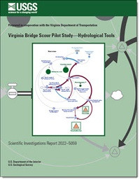
Virginia Bridge Scour Pilot Study—Hydrological Tools

Prepared in cooperation with the Virginia Department of Transportation

First posted October 18, 2022

For additional information, contact:

Director, Virginia and West Virginia Water Science Center

https://www.usgs.gov/centers/virginia-and-west-virginia-water-science-ce nter

U.S. Geological Survey

1730 East Parham Road

Richmond, Virginia 23228

Abstract

Hydrologic and geophysical components interact to produce streambed scour. This study investigates methods for improving the utility of estimates of hydrologic flow in streams and rivers used when evaluating potential pier scour over the design-life of highway bridges in Virginia. Recent studies of streambed composition identify potential bridge design cost savings when attributes of cohesive soil and weathered rock unique to certain streambeds are considered within the bridge planning design. To achieve potential cost savings, however, attributes and effects of scour forces caused by water movement across the streambed surface must be accurately described and estimated.

This study explores the potential for improving estimates of the hydrologic component, namely hydrologic flow, afforded by empirically based deterministic, probabilistic, and statistical modeling of flows using streamgage data from 10 selected sites in Virginia. Methods are described and tools are provided that may assist with estimating hydrological components of flow duration and potential cumulative stream power for bridge designs in specific settings, and calculation of comprehensive projections of anticipated individual bridge pier scour rates. Examples of hydrologic properties needed to determine the rates of streambed scour are described for sites spanning a range of basin sizes and locations in Virginia. Deterministic, probabilistic, and statistical modeling methods are demonstrated for estimating hydrological components of streambed scour over a bridge design lifespan. Eight tools provide examples of streamflow analysis using daily and instantaneous streamflow data collected at 10 study sites in Virginia. Tool 1 provides a generalized system dynamics model of streamflow and sediment motion that may be used to estimate hydrologic flow over time. Tool 2 illustrates at-a-station hydraulic geometry using methods pioneered by Leopold and others. Tool 3 provides a system dynamics model developed to test the use of Monte-Carlo sampling of instantaneous streamflow measurements to augment and increase precision of site-specific period-of-record daily-flow values useful for driving stream-power and streambed scour estimates. Tool 4 integrates deterministic modeling, maximum likelihood logistic regression, and Monte-Carlo sampling to identify probable hydrologic flows. Tool 5 provides instantaneous flow hydrologic envelope profiles, using measured instantaneous flow data integrated with measured daily-flow value data. Tool 6 provides precise estimates of hydrologic flow over entire data time-series suitable for driving scour simulation models. Tool 7 provides a threshold of flow and probability of time-under-load interactive calculator that allows selection of a desired bridge design lifespan, ranging from 1 to 250 years, and identification of a flow interval of interest. Tool 8 provides a flow-random sampling interactive tool, developed to facilitate easy access to large datasets of randomly sampled flow data measurements from unique locations for purposes of computing and testing future models of bridge pier scour.

Survey Date
2022
Print Date
2022
Height In Inches
11.000
Length In Inches
8.500
Two Sided
Yes
Pieces
1
Languages
English
Related Items
REVISIONS TO THE VIRGINIA COASTAL PLAIN
Revisions to the Virginia Coastal Plain Hydrogeologic Framework Southwest of the James River <p> <p> First posted June 23, 2022 <p> For additional information, contact: <p> Director, Virginia and West Virginia Water Science Center <p> https://www.usgs.gov/centers/virginia-and-west-virginia-water-science-ce nter <p> U.S. Geological Survey <p> 1730 East Parham Road <p> Richmond, VA 23228 <p> <p> Abstract <p> <p> hydrogeologic units of the Virginia Coastal Plain aquifer system differ by as much as 50 feet (ft) from those previously known, namely the Aquia and Potomac aquifers, the Potomac confining zone, and the Nanjemoy-Marlboro and Saint Marys confining units. In addition, the lateral margins of some hydrogeologic units are located as much as several miles from previously estimated locations. The largest revisions to unit margins were for the Aquia aquifer and the Nanjemoy-Marlboro and Saint Marys confining units. Interpretation of new geophysical logs, sediment core, and cuttings as well as revised interpretations to existing data indicate channels and embayments are also preserved on eroded top surfaces of the shallowest hydrogeologic units including the Yorktown confining zone, Yorktown-Eastover aquifer, Saint Marys confining unit, Potomac confining zone, and Potomac aquifer. <p> <p> Enhanced details on the configuration of part of the aquifer system southwest of the James River are provided by sediment cores and cuttings as well as geophysical logs from 36 recently drilled boreholes. These, along with reinterpretation of data from 93 preexisting boreholes, form the basis for revised top-surface altitudes and margins of hydrogeologic units beneath parts of Prince George, Surry, Sussex, Isle of Wight, and Southampton Counties and the cities of Franklin and Suffolk. <p> <p> Groundwater withdrawals in the Virginia Coastal Plain cause widespread water-level declines, create the potential for saltwater intrusion, and contribute to regionwide land subsidence. A description of the aquifer system, termed a hydrogeologic framework, was developed by the U.S. Geological Survey in 2006 and provides information needed to base withdrawal-permitting decisions by the Virginia Department of Environmental Quality. This revision of part of the hydrogeologic framework southwest of the James River is based on interpretations of both new and previously analyzed borehole data. The revision is strictly confined to the study area extent and hydrogeologic units not found within the study area were not revised and are not discussed in this report. The newly determined hydrogeologic-unit altitudes and margins have implications for groundwater-withdrawal permitting. New interpretations have found that the Yorktown Eastover aquifer is absent in the southwestern part of the City of Suffolk, owing to what is most likely an isolated area of sediment-texture facies change. Most notably, the top-surface altitudes of the Aquia and Potomac aquifers have been lowered by as much as 50 ft from previous interpretations. This means that wells previously believed to be screened in the top of the Potomac aquifer could, based on these new interpretations, be screened in the bottom of the Aquia aquifer. These changes to aquifers in which wells are screened means that there is potentially more room in the groundwater withdrawal permitting for the Potomac aquifer, the largest and most productive aquifer in Virginia, and overpumping occurring in the Aquia aquifer. <p>
STREAMS OF FAIRFAX COUNTY, VA
Evaluating Drivers of Hydrology, Water Quality, and Benthic Macroinvertebrates in Streams of Fairfax County, Virginia, 2007–18 <p> <p> Scientific Investigations Report 2023-5027 <p> <p> Prepared in cooperation with Fairfax County, Virginia <p> By: James S. Webber, Jeffrey G. Chanat, Aaron J. Porter, and John D. Jastram <p> <p> https://doi.org/10.3133/sir20235027 <p> <p> First posted May 18, 2023 <p> For additional information, contact: <p> Director, Virginia and West Virginia Water Science Center <p> https://www.usgs.gov/centers/virginia-and-west-virginia-water-science-ce nter <p> U.S. Geological Survey <p> 1730 East Parham Road <p> Richmond, VA 23228 <p> <p> Abstract <p> <p> In 2007, the U.S. Geological Survey partnered with Fairfax County, Virginia, to establish a long-term water-resources monitoring program to evaluate the hydrology, water quality, and ecology of Fairfax County streams and the watershed-scale effects of management practices. Fairfax County uses a variety of management practices, policies, and programs to protect and restore its water resources, but the effects of such strategies are not well understood. This report used streamflow, water-quality, and ecological monitoring data collected from 20 Fairfax County watersheds from 2007 through 2018 to assess the effects of management practices, landscape factors, and climatic conditions on observed nutrient, sediment, salinity, and benthic-macroinvertebrate community responses. <p> <p> Urbanization, climatic variability, and an increase in management practices occurred within Fairfax County during the study period. Impervious cover, housing units, wastewater infrastructure, and (or) stormwater infrastructure increased in most study watersheds. Climatic conditions varied among study years; countywide estimates of average-annual air temperature differed by about 3 degrees Celsius, and total precipitation ranged from about 34 to 63 inches per year. The effects of the management practices, implemented to reduce nitrogen, phosphorus, and (or) sediment loads, are considered in this study. These management practices primarily consist of stormwater retrofits and stream restorations; however, stream restorations account for most of the financial investment and expected load reductions. Management practices were implemented in half of the study watersheds, and most practices were installed and reductions credited late in the study period. <p> <p> Changes in hydrologic response during storm events were evaluated over the study period because many management practices that were implemented were designed to achieve nutrient and sediment reductions by slowing or intercepting runoff. The average number and length of storm events was mostly unchanged throughout the monitoring network. Four watersheds with 10 years of streamflow data showed a mixture of trends in stormflow peak, volume, and rate-of-change. Event-mean nutrient and sediment concentrations from these watersheds were evaluated during storm events and generally showed increases in total phosphorus (TP) and suspended sediment and reductions or no changes in total nitrogen (TN). <p> <p> Landscape inputs of nitrogen and phosphorus and the percentage of inputs delivered to streams were estimated for the study watersheds. Estimated phosphorus from fertilizer and nitrogen from atmospheric deposition represented large nutrient inputs in most watersheds; amounts of other nonpoint sources varied based on land use. Estimated nitrogen inputs declined throughout Fairfax County and in most study watersheds from 2008 through 2018; in comparison, phosphorus input changes were relatively small. Most nonpoint-nutrient inputs were retained on the landscape and did not reach streams, with slightly more nitrogen retention than phosphorus, on average. Retention rates were lower for years with more precipitation and streamflow. After adjusting for streamflow, TN and TP loads were generally higher for years with more nutrient inputs. Calculated as a function of flow-adjusted loads, TP retention declined at most stations from 2009 through 2018, in comparison, TN retention was relatively unchanged. Landscape and climatic conditions affected spatial differences and changes in Fairfax County stream conditions from 2009 through 2018. TN concentrations were higher and increases over time were larger in watersheds with elevated septic-system density. TP concentrations were higher in watersheds with more turfgrass; concentrations were lower, but had larger increases over time, in watersheds with deeper soils. Suspended-sediment concentrations were higher in watersheds with greater stream densities. Specific conductance was higher in watersheds with more developed land use and shallower soils. Benthic-macroinvertebrate index of biotic integrity (IBI) scores were lower in watersheds with high road density and had larger increases over time in bigger, more developed watersheds. Annual variability in TN and TP concentrations and benthic-macroinvertebrate IBI scores was affected by precipitation; annual variability in suspended sediment concentrations and specific conductance was affected by air temperature. <p> <p> After accounting for influences from landscape and climatic conditions, expected management-practice effects were not consistently observed in monitored stream responses. These effects were assessed by comparing expected management-practice load reductions with the timing, direction, and magnitude of changes in storm-event hydrology, nutrient and sediment loads, median-annual water-quality conditions, and benthic-macroinvertebrate IBI scores. An important consideration for future investigations of management-practice effects is how to control for water-quality and ecological variability caused by geologic properties, the urban environment, precipitation, and (or) air temperature. The interpretation of management-practice effects in this report was likely influenced by a combination of factors, including (1) the amount, timing, and location of management-practice implementation; (2) unmeasured landscape and climatic factors; (3) uncertain management-practice expectations; (4) hydrologic variability; and (5) analytical assumptions. Through continued data-collection efforts, particularly after management practices have been completed, many of these factors may become less influential in the future. <p>
STORMWATER QUANTITY AND QUALITY, VA
Stormwater Quantity and Quality in Selected Urban Watersheds in Hampton Roads, Virginia, 2016–2020 <p> <p> Prepared in cooperation with the Hampton Roads Planning District Commission <p> <p> First posted November 23, 2022 <p> For additional information, contact: <p> Director, Virginia and West Virginia Water Science Center <p> https://www.usgs.gov/centers/virginia-and-west-virginia-water-science-ce nter <p> U.S. Geological Survey <p> 1730 East Parham Road <p> Richmond, Virginia 23228 <p> <p> Abstract <p> <p> Urbanization can substantially alter sediment and nutrient loadings to streams. Although a growing body of literature has documented these processes, conditions may vary widely by region and physiographic province (PP). Substantial investments are made by localities to meet federal, state, and local water-quality goals and locally relevant monitoring data are needed to appropriately set standards and track progress. In 2016, a long-term stormwater monitoring program was initiated to characterize water-quality and streamflow conditions and compute average annual nutrient- and sediment-loading rates across the three dominant land-use types—commercial (COM), high-density residential, and single-family residential (SFR)—in the Hampton Roads metropolitan region within the Coastal Plain PP in southeastern Virginia. This report summarizes the first five years of data collection to (1) assess patterns in streamflow and water chemistry across the three major land-use types in the region; (2) compute annual sediment and nutrient loads; and (3) compare annual loading rates to those in other urbanized regions. <p> <p> Patterns in watershed hydrology characteristics and conditions were similar to those observed in other urban monitoring studies. Base-flow indices were lower and stream flashiness indices were higher in the study watersheds compared to those in less developed reference watersheds. These patterns reflect a decrease in infiltration and consequent increase in storm runoff as a result of urbanization. Stream flashiness was strongly positively related to degree of impervious land cover and negatively to watershed area. Hydrologic metrics varied across the land-use gradient, reflecting greater and more rapid runoff in the COM watersheds than in SFR watersheds. Event-based analyses conducted exclusively on periods of runoff highlight longer duration events, longer time-to-peak streamflow, and a longer lag between peak precipitation and peak streamflow in SFR watersheds, and higher stormflow yields, runoff ratios, and peak flows in COM watersheds. Event-based metrics varied seasonally because of regional meteorological patterns. <p> <p> Concentrations of total suspended solids (TSS) and total phosphorus (TP) were positively correlated to streamflow, whereas concentrations of total nitrogen (TN) varied little across the hydrologic regime. Phosphorus composition varied spatially and seasonally—the proportion of orthophosphate (PO43-) was highest in samples collected from stations draining residential land-use types and was elevated in summer and fall. Nitrogen composition varied with hydrologic condition: nitrate plus nitrite (NO3-) dominance during base flow shifted to total organic nitrogen (TON) dominance during periods of runoff. For all three major constituents (TSS, TP, and TN), concentrations were highest in SFR watersheds, whereas yields were greatest in COM watersheds. This seeming contradiction in concentration and yield across land-use types occurred because of spatial differences in streamflow yield. <p> <p> The network average TSS yield in Hampton Roads was lower than that in comparable networks in Fairfax County, Virginia, and Gwinnett County, Georgia, a difference that may reflect dissimilarities in the topographic and soil characteristics of the Coastal Plain versus those in Piedmont PPs, as well as differences in engineered concrete stormwater conveyances versus earthen streams. The average annual TP yield in Hampton Roads was higher than averages reported in comparison studies and was primarily driven by elevated PO43-. Elevated PO43- yields may be related to unique soil and geological features of the Coastal Plain PP that limit phosphorus retention. Total nitrogen yields in the Hampton Roads and Fairfax County networks were similar; however, composition did vary, with greater total organic nitrogen yields in Hampton Roads and greater NO3- yields in Fairfax County. <p> <p> Cross-correlation analyses and mass-volume curves were used to assess the timing of sediment and nutrient loadings. The majority of TSS and TP was typically transported during the initial phase of a storm-runoff event, a phenomenon commonly termed the “first flush.” Although TN concentrations typically peaked within an hour of peak streamflow, reflecting the particulate dominance of TN during stormflows, and loadings were greater during the early phase of most storm events, the stricter first-flush criterion was rarely met. This suggests that the most abundant sources of TN in these watersheds are not as directly connected to the stormwater-conveyance system as are TSS and TP. <p>