Product

MARINE MINERALS IN ALASKA A REVIEW OF

$16.00
Available

Product Details

Product Number
534143
Series
PP-1870
Scale
NO SCALE
Alternate ID
16-1870
ISBN
978-1-4113-4475-4
Authors
AMY GARTMAN
Version Date
01/01/2022
Regions
AK
Countries
USA
Media
Paper
Format
Bound

Additional Details

Description

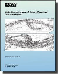
Marine minerals in Alaska — A review of coastal and deep-ocean regions

First posted July 14, 2022

For additional information, contact: Pacific Coastal and Marine Science Center U.S. Geological Survey 2885 Mission St. Santa Cruz, CA 95060

Abstract

Minerals occurring in marine environments span the globe and encompass a broad range of mineral categories, forming within varied geologic and oceanographic settings. They occur in coastal regions, either from the continuation or mechanical reworking of terrestrial mineralization, as well as in the deep ocean, from diagenetic, hydrogenetic, and hydrothermal processes. The oceans cover most of the Earth’s surface and as a result, any inventory of global resources is incomplete without the inclusion of marine minerals. This study by the U.S. Geological Survey reviews current knowledge regarding deep-ocean and coastal marine minerals within the marine areas surrounding Alaska, including the Alaska Outer Continental Shelf (OCS). For the purposes of this study, we have divided these areas in to eight regions: (1) Gulf of Alaska seamounts, (2) Chukchi Borderland, (3) Canada Basin, (4) Aleutian Arc, (5) Seward Peninsula, (6) Goodnews Bay, (7) Bristol Bay and Alaska Peninsula, and (8) southern and southeastern Alaska. The Alaska OCS encompasses several areas broadly conducive to marine mineral formation, including extensional basins resulting from an active subduction zone where massive sulfide deposits may form, deep abyssal plains with conditions that may lead to manganese nodule formation, seamounts that can provide substrate for the growth of ferromanganese crusts, and erosional settings and submerged continental crust where placer deposits are found. For deep-ocean hydrothermal minerals and manganese nodules, the Alaska OCS contains prospective regions, including the Canada Basin and the Aleutian Arc; however, no such minerals have yet been identified. We explore the probability that these minerals occur based on reviews of existing geologic and oceanographic data within the relevant sections. In regions far from shore data are limited. Deep-ocean ferromanganese crusts are known to occur in two regions: (1) the Gulf of Alaska seamounts and (2) the Chukchi Borderland in the Arctic Ocean. Limited sampling has occurred in both regions, and along the Chukchi Borderland the sampling was outside of the OCS and the U.S. Exclusive Economic Zone. Data relevant to coastal minerals is more extensive, and in some places fairly systematic sampling was conducted. Several nearshore placer deposits have been exploited for decades; however, the potential for nearshore extension of terrestrial ore deposits is less well considered. This contribution considers the state of knowledge regarding marine mineral occurrences within the Alaska regions and identifies the data gaps in order to help inform future marine mineral related research efforts around Alaska.

Print Date
2022
Height In Inches
11.000
Width In Inches
0.220
Length In Inches
8.500
Two Sided
Yes
Pieces
1
Languages
English
Related Items
ELMIRA-WILLIAMSPORT REGION, NY & PA
<p> Surficial geology and soils of the Elmira-Williamsport region, New York and Pennsylvania, with a section on forest regions and great soil groups <p> <p> Professional Paper 379 <p> By: Charles Storrow Denny, Walter Henry Lyford, and J. C. Goodlett <p> https://doi.org/10.3133/pp379 <p> <p> Abstract <p> <p> The Elmira-Williamsport region, lying south of the Finger Lakes in central New York and northern Pennsylvania, is part of the Appalachian Plateaus physiographic province. A small segment of the Valley and Ridge province is included near the south border. In 1953 and 1954, the authors, a geologist and a soil scientist, made a reconnaissance of about 5,000 square miles extending southward from the Finger Lakes, N.Y., to Williamsport, Pa., and eastward from Wellsboro, Pa., to Towanda, Pa. Glacial drift of Wisconsin age, covering the central and most of the northern parts of the region, belongs to the Olean substage of MacClintock and Apfel. This drift is thin and patchy, is composed of the relatively soft sandstones, siltstone, shales, and conglomerates of the plateaus, commonly has a low calcium carbonate content, and is deeply leached. Mantling its surface are extensive rubbly colluvial deposits. No conspicuous terminal moraine marks the relatively straight border of Olean drift. The Valley Heads moraine of Fairchild near the south ends of the Finger Lakes is composed of relatively thick drift containing a considerable amount of somewhat resistant sedimentary and crystalline rocks. Commonly this drift has a relatively high carbonate content and is leached to only shallow depths. The Valley Heads drift is younger than Olean, but its precise age is undetermined. The age of the Olean is perhaps between Sangamon and Farmdale, on the basis of, in part, a carbon-14 date from peat at Otto, N.Y. All differences in soil development on these two Wisconsin drifts are clearly related to the lithology of the parent material or the drainage, rather than to weathering differing in kind or in duration. The authors believe that the soils are relatively young, are in equilibrium with the present environment, and contain few, if any, features acquired during past weathering intervals. The effect of tree throw on soil profiles and the presence of soils on slopes clearly indicate that soils form rapidly. Sols Bruns Acides are the most extensive great soil group occurring throughout the region. Podzols and Gray-Brown Podzolic soils are also widespread, and on long, smooth slopes Low Humic-Gley soils are common. Organic soils are of small extent. South of the Wisconsin drift border, the surficial mantle consists chiefly of alluvial, colluvial, or residual deposits of Wisconsin or of Recent age, but there are many small isolated patches of older, strongly weathered materials of pre-Wisconsin age. Although such older materials are commonly overlain or mixed with less weathered mantle, the yellowish-red color, characteristic of the strongly weathered material, is generally not masked. Some of the older material is drift, presumed to be of Illionian age, that was probably strongly weathered to a considerable depth in Sangamon time and has been greatly eroded since the last interglacial period. No clear-cut exposure of Wisconsin drift resting on older drift or other strongly weathered mantle has been found. The old drift and the other strongly weathered materials apparently acquired their present red color in pre-Wisconsin time. Where exposed at the surface, such strongly weathered mantle is the parent material of modern Red-Yellow Podzolic soils. Sols Bruns Acides and Gray-Brown Podzolic soils, developed on slightly weathered parent materials, are found adjacent to these red soils. This suggests that these Red-Yellow Podzolic soils probably developed from strongly weathered parent materials. No buried soils were found nor were any soils recognized as relics from pre-Wisconsin time. Comparison of a map of the great soil groups with a map of the vegetation of the region, prepared by John C. Goodlett, does not reveal a close relation. Laboratory analyses of samples collected furnish data on textural, mineralogical, and chemical changes caused by weathering and soil formation. The results indicate that the amount of chemical weathering which the Wisconsin drift has undergone is slight. The Red-Yellow Podzolic soils on strongly weathered pre-Wisconsin drift have B2 horizons that have a finer texture than the A2 or C horizons. The parent materials of these soils seem to be strongly weathered because of the high chromas, reddish hues, friable condition of most rock fragments, relatively high kaolinite content, and presence of gibbsite in the clay fraction. Measurements at numerous localities show that the depth of leaching increases with decreasing carbonate content and is not a criterion of the age of the drift. Pebble counts of gravels also show that the depth of leaching of gravel is related to its limestone content. The location of the gravel deposits is probably due primarily to the presence of pebbles of resistant rock rather than to ice wastage involving abundant glacial melt water. The region is in the Susquehanna drainage basin except for its north fringe, which drains to Lake Ontario. Most of the region is a dissected plateau ranging in altitude from 700 to 2,500 feet and underlain by gently folded sedimentary rocks of Paleozoic age. Much of the region slopes moderately or steeply; the most extensive areas of gently sloping land are 011 the uplands. In the northern part are several straight and deep valleys the southern extension of the Finger Lakes basins separated by uplands with several low cuestas that face north. Similarly, some streams such as the Canisteo, Cohocton, and Chemung Rivers, and the part of the Susquehanna River that is in New York, trend at right angles to the Finger Lakes, flowing in valleys that parallel the regional strike of the bedrock. The Olean drift border is marked by a change from drift containing very few rounded or striated rock fragments to a mantle containing only angular rock fragments and traces of red, strongly weathered materials. A reconstruction of the surface of the ice sheet, at its maximum extent shows an inferred slope of its distal margin ranging from 100 to 500 feet per mile <p>
HEXAVALENT CHROMIUM, CR(VI), GROUNDWATER
Natural and Anthropogenic (Human-Made) Hexavalent Chromium, Cr(VI), in Groundwater near a Mapped Plume, Hinkley, California <p> <p> Professional Paper 1885 <p> <p> Prepared in cooperation with the Lahontan Regional Water Quality Control Board <p> By: John A. Izbicki <p> <p> https://doi.org/10.3133/pp1885 <p> <p> First posted April 25, 2023 <p> For additional information, contact: Director, dc_ca@usgs.gov <p> California Water Science Center https://ca.water.usgs.gov/ <p> U.S. Geological Survey https://usgs.gov/ <p> 6000 J Street, Placer Hall <p> Sacramento, California 95819 <p> <p> Abstract <p> <p> Between 1952 and 1964, hexavalent chromium, Cr(VI), was released into groundwater from the Pacific Gas and Electric Company (PG&E) Hinkley compressor station in the Mojave Desert 80 miles (mi) northeast of Los Angeles, California. Remediation began in 1992, and in 2010, site cleanup was projected to require between 10 and 95 years and was expected to cost between $36 and $176 million. A 2007 PG&E study estimated the natural Cr(VI) background in groundwater in Hinkley Valley to be 3.1 micrograms per liter (μg/L). This concentration was used for interim regulatory purposes by the Lahontan Regional Water Quality Control Board (RWQCB). In the fourth quarter (October–December) 2015, the regulatory Cr(VI) plume extended about 3.0 mi downgradient from the release location within the Hinkley compressor station, while groundwater having Cr(VI) concentrations greater than 3.1 μg/L was present more than 8 mi downgradient. Although rocks and minerals in the area are naturally low in chromium, alluvium eroded from the San Gabriel Mountains and transported to Hinkley Valley by the Mojave River, and locally small exposures of mafic rock, including hornblende diorite and basalt, may contribute Cr(VI) to groundwater. In response to limitations of the PG&E 2007 Cr(VI) background study’s methodology, uncertainty in the natural Cr(VI) background concentration, and an increase in the mapped extent of groundwater having Cr(VI) concentrations greater than the interim regulatory background of 3.1 μg/L, the Lahontan RWQCB concluded that the 2007 PG&E background Cr(VI) study should be updated. The purpose of the updated study is to estimate background Cr(VI) concentrations in groundwater within the upper aquifer upgradient, downgradient, near the margins, and within the footprint of the PG &E Cr (VI) plume in Hinkley, California. The scope of the study included eight tasks; results from those tasks are presented in the chapters within this professional paper. <p>
ARCTIC ALASKA BOUNDARY AREA AS DEFINED
Maps of the Arctic Alaska Boundary Area as Defined by the U.S. Arctic Research and Policy Act—Including Geospatial Characteristics of Select Marine and Terrestrial Features <p> <p> Scientific Investigations Map 3484 <p> <p> First posted November 30, 2021 <p> For additional information, contact: <p> Regional Director, Alaska <p> https://www.usgs.gov/unified-interior-regions/region-11 <p> U.S. Geological Survey <p> 4210 University Drive <p> Anchorage, Alaska 99508-4560 <p> <p> Abstract <p> <p> This pamphlet presents a series of general reference maps showing relevant geospatial features of the U.S. Arctic boundary as defined by the U.S. Congress since 1984. The first generation of the U.S. Arctic Research and Policy Act (ARPA) boundary maps was originally formatted and published in 2009 by a private firm contracted with the National Science Foundation and the U.S. Arctic Research Commission. Recognizing the steadily increasing relevance of Arctic issues to national and global affairs that requires more functional projections and online tools, the U.S. Geological Survey (USGS) Alaska Regional Office and the National Geospatial Technical Operations Center developed this updated series of ARPA boundary maps. Map sheet 1 shows the ARPA boundary as it relates to Alaska and marine features of the Bering Sea. Map sheet 2 shows the ARPA boundary from a circumpolar perspective. Map sheet 3 shows the national boundary of the U.S. 200-nautical-mile Exclusive Economic Zone through the Bering, Chukchi, and Beaufort Seas, facilitating Arctic domain awareness and more consistent territorial assessments of the U.S. Arctic. Map sheet 4 shows, in poster-size detail, the ARPA boundary as it relates to terrestrial features of Arctic Alaska north of the Yukon and Kuskokwim Rivers. Map sheet 5 shows, in poster-size detail, the ARPA boundary as it relates to marine and terrestrial features of the Aleutian Islands. These new maps collectively illustrate several value-added attributes, including updated bathymetry and shoreline refinements, demographic information, international borders and offshore territorial claims, Alaska conservation areas, Alaska land cover, Alaska terrestrial shaded relief, annual sea ice maximum extent, annual circumpolar 10-degree-Celsius isotherm, location of active volcanoes, and updated geospatial information. The static PDF-file maps offer value as standalone products but are intended for use with a potential interactive website that can be sourced by annual data updates, allowing users to access the various map layers in a dynamic up-to-date environment. <p>