Product

ECOLOGICAL STATUS AND TRENDS UPPER RIVER

$16.00
Available

Product Details

Product Number
534146
Series
OFR-2022-1039
Scale
NO SCALE
Alternate ID
OFR-2022-1039
ISBN
978-1-4113-4473-0
Authors
EDITED BY JEFFREY N HOUSER
Version Date
01/01/2022
Regions
IA, IL, IN, MN, MO, ND, SD, WI
Countries
USA
Media
Paper
Format
Printed but Unbound
Digital Reproduction
Yes

Additional Details

Description

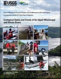
Ecological status and trends of the Upper Mississippi and Illinois Rivers

First posted June 22, 2022

Revised July 14, 2022

For additional information, contact: Director, Upper Midwest Environmental Sciences Center U.S. Geological Survey 2630 Fanta Reed Road La Crosse, WI 54603

Contact Pubs Warehouse

Executive Summary

This report assesses the status and trends of selected ecological health indicators of the Upper Mississippi River System (UMRS) based on the data collected and analyzed by the Long Term Resource Monitoring element of the Upper Mississippi River Restoration program, supplemented with data from other sources. This report has four objectives: providing a brief introduction of the UMRS, including its significance, history, modern-day stressors, and recent research; using ecological indicators to describe the status of the river system and where and how it has changed from circa 1993 to 2019; discussing management and restoration implications of these changes; and highlighting the fundamental role of long-term monitoring in the understanding, management, and restoration of large-floodplain rivers.

The data were collected in the six Long Term Resource Monitoring element study reaches that spanned much of the UMRS and the various gradients contained therein. These study reaches included Navigation Pools 4, 8, 13, and 26; the part of the Unimpounded Reach of the Upper Mississippi River between Grand Tower and Cairo, Illinois; and the La Grange Pool on the Illinois River. The indicators included in this report describe the status and trends for the hydrology, geomorphology, floodplain vegetation, water quality, vegetation, and fishes of the UMRS. Many of the indicators of river ecosystem health changed significantly over the nearly 30 years of our evaluation. However, there was substantial spatial variability in the magnitude and timing of those changes among study reaches. Few indicators changed everywhere or nowhere; most indicators changed in some reaches but not others. The quantitative assessments of these indicators describe how the conditions of the river differ across hydrogeomorphic and climate gradients and through time and are intended to support the restoration and management of the UMRS.

Height In Inches
11.000
Width In Inches
0.500
Length In Inches
8.500
Two Sided
Yes
Pieces
1
Related Items
ECOSYSTEM UPPER MISSISSIPPI RIVER SYSTEM
Indicators of Ecosystem Structure and Function for the Upper Mississippi River System
RIVER MASTER, DELAWARE RIVER 2013 - 2014
Report of the River Master of the Delaware River for the Period December 1, 2013–November 30, 2014 <p> <p> Open-File Report 2023-1084 <p> Water Availability and Use Science Program <p> By: Kendra L. Russell, William J. Andrews, Vincent J. DiFrenna, J. Michael Norris, and Robert R. Mason, Jr. <p> <p> https://doi.org/10.3133/ofr20231084 <p> <p> For additional information, contact: <p> Delaware River Master <p> https://webapps.usgs.gov/odrm/ <p> <p> Office of the Delaware River Master <p> U.S. Geological Survey <p> 120 Route 209 <p> South Milford, PA 18337 <p> <p> Executive Summary <p> <p> A Decree of the Supreme Court of the United States, entered June 7, 1954 (New Jersey v. New York, 347 U.S. 995), established the position of Delaware River Master within the U.S. Geological Survey. In addition, the Decree authorizes the diversion of water from the Delaware River Basin and requires compensating releases from specific reservoirs owned by New York City to be made under the supervision and direction of the River Master. The Decree stipulates that the River Master provide reports to the Court, not less frequently than annually. This report is the 61st annual report of the River Master of the Delaware River. The report covers the 2014 River Master report year, which is the period from December 1, 2013, to November 30, 2014. <p> <p> During the report year, precipitation in the upper Delaware River Basin was 42.40 inches or 95 percent of the long-term average. On December 1, 2013, combined useable storage in New York’s Pepacton, Cannonsville, and Neversink Reservoirs in the upper Delaware River Basin was 200.133 billion gallons or 73.9 percent of the combined capacity of 270.8 billion gallons. The reservoirs were at about 99.7 percent of usable capacity on May 31, 2014. Combined storage in the Pepacton, Cannonsville, and Neversink Reservoirs decreased below 80 percent of combined capacity in late August. The lowest combined storage was 151.730 billion gallons or 56 percent of combined capacity on November 24, 2014. Delaware River Master operations during the year were conducted as stipulated by the Decree and the Flexible Flow Management Program. <p> <p> Diversions from the Delaware River Basin by New York City and the State of New Jersey fully complied with the Decree. Reservoir releases were made as directed by the River Master at rates designed to meet the flow objective for the Delaware River at Montague, New Jersey, on 94 days during the report year. Interim Excess Release Quantity and conservation releases, designed to relieve thermal stress and protect the fishery and aquatic habitat in the tailwaters of the reservoirs, were also made during the report year. <p> <p> Water quality in the Delaware River estuary between streamgages at Trenton, New Jersey, and Reedy Island Jetty, Delaware, was monitored at several locations. Data on water temperature, specific conductance, dissolved oxygen, and pH were collected continuously by electronic instruments at four locations. <p>
BENTHIC ALGAE IN UPPER WHITE RIVER BASIN
Potential Factors Controlling Benthic Algae in the Upper White River Basin, Colorado, 2018–21 <p> Fact Sheet 2023-3005 <p> Prepared in cooperation with White River and Douglas Creek Conservation Districts, Colorado River Salinity Control Forum, Colorado River Water Conservation District <p> By: Rachel G. Gidley and Natalie K. Day <p> <p> </p> <font color=red> <p> This product is not available for order, it can only be downloaded from here (click on image) or within the Publications Warehouse at https://pubs.er.usgs.gov/publication/fs20233005 </p> </i> </font> <p> <p> For additional information, contact: <p> Director, Colorado Water Science Center <p> https://www.usgs.gov/centers/colorado-water-science-center/ <p> <p> U.S. Geological Survey <p> Box 25046, Mail Stop 415 <p> Denver, CO 80225 <p> <p> Abstract <p> <p> Nuisance levels of benthic algae are becoming increasingly common in surface waters of the western United States and can compromise aesthetic quality, limit recreational activities, block water infrastructure, and negatively affect aquatic life. In cooperation with the White River and Douglas Creek Conservation Districts, the Colorado River Basin Salinity Control Forum, and the Colorado River Water Conservation District, the U.S. Geological Survey studied physical, chemical, and biological factors potentially controlling the occurrence of benthic algae in the upper White River Basin, Colorado, from 2018 through 2021. Multiple approaches were used to assess nutrients and physical conditions in the upper White River Basin. A linear mixed-effects model was used to evaluate the relative effect of different factors on algal biomass across water-quality sites. <p> <p> The frequency and severity of algal blooms in the upper White River Basin may be affected by long-term changes in nutrient availability and streamflow, specifically changes in the timing and magnitude of high and low streamflow. The effects of large peak streamflow, including movement of the streambed, may be the dominant control on the occurrence of algal blooms through years. Large, late, and long-lasting peak streamflow may limit algal blooms during the same year and into subsequent years. Without streambed disturbance, other factors such as nutrients and water temperature may have a larger effect on algal biomass. <p>