

Product Details
- Product Number
- 519554
- Series
- SIR-2015-5105
- Scale
- NO SCALE
- Alternate ID
- SIR-2015-5105
- ISBN
- 978-1-4113-4109-8
- Authors
- AUBREY R BUNCH
- Version Date
- 01/01/2015
- Regions
- MA, ME, MI, MN, MO, MT, ND, NE, NH, NJ, NY, OH, PA, RI, SD, VT, WA, WI, KS, IN, IL, ID, CT, AK
- Countries
- USA
- Media
- Paper
- Format
- Bound
Additional Details
- Description
-
Abstract
As part of the National Water Availability and Use Program established by the U.S. Geological Survey (USGS) in 2005, this study took advantage of about 14 million records from State-managed collections of water-well drillers’ records and created a database of hydrogeologic properties for the glaciated United States. The water-well drillers’ records were standardized to be relatively complete and error-free and to provide consistent variables and naming conventions that span all State boundaries.
Maps and geospatial grids were developed for (1) total thickness of glacial deposits, (2) total thickness of coarse-grained deposits, (3) specific-capacity based transmissivity and hydraulic conductivity, and (4) texture-based estimated equivalent horizontal and vertical hydraulic conductivity and transmissivity. The information included in these maps and grids is required for most assessments of groundwater availability, in addition to having applications to studies of groundwater flow and transport. The texture-based estimated equivalent horizontal and vertical hydraulic conductivity and transmissivity were based on an assumed range of hydraulic conductivity values for coarse- and fine-grained deposits and should only be used with complete awareness of the methods used to create them. However, the maps and grids of texture-based estimated equivalent hydraulic conductivity and transmissivity may be useful for application to areas where a range of measured values is available for re-scaling.
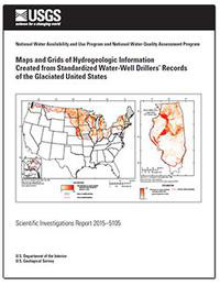
Maps of hydrogeologic information for some States are presented as examples in this report but maps and grids for all States are available electronically at the project Web site (USGS Glacial Aquifer System Groundwater Availability Study, http://mi.water.usgs.gov/projects/WaterSmart/Map-SIR2015-5105.html) and the Science Base Web site, https://www.sciencebase.gov/catalog/item/58756c7ee4b0a829a3276352.
- Print Date
- 2017
- Height In Inches
- 11.000
- Width In Inches
- 0.150
- Length In Inches
- 8.500
- Two Sided
- Yes
- Pieces
- 1
- Languages
- English

