Product

HUNTSVILLE, GEOLOGY OF, AL

$9.00
Available

Product Details

Product Number
26029
Series
I-329
Scale
1:24,000
Alternate ID
GI0329D
ISBN
978-0-607-77095-7
Authors
SANFORD, T. H., JR.
Version Date
01/01/1961
Regions
AL
Countries
USA
Media
Paper
Format
Flat
Digital Reproduction
Yes

Additional Details

Description
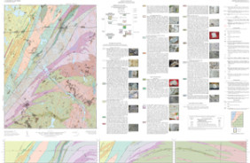
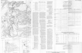
Geology of the Huntsville quadrangle, Alabama

IMAP 329

Prepared in cooperation with the City of Hunstville and Geological Survey of Alabama

By: T.H. Sanford Jr., G.T. Malmberg, and L.R. West

https://doi.org/10.3133/i329

Abstract

The 7 1/2-minute Huntsville quadrangle is in south-central Madison County, Ala., and includes part of the city of Hunstville. The south, north, east, and west boundaries of the quadrangle are about 3 miles north of the Tennessee River, 15 1/2 miles south of the Tennessee line, 8 miles west of the Jackson County line, and 9 miles east of the Limestone County line.

The bedrock geology of the Huntsville quadrangle was mapped by the U.S. Geological Survey in cooperation with the city of Hunstville and the Geological Survey of Alabama as part of a detailed study of the geology and ground-water resources of Madison County, with special reference to the Huntsville area. G. T. Malmberg began the geologic mapping of the county in July 1953, and completed it in April 1954. T. H. Sanford, Jr., assisted Malmberg in the final phases of the county mapping, which included measuring geologic sections with hand level and steel tape. In November 1958 Sanford, assisted by L. R. West, checked contacts and elevations in the Hunstville quadrangle; made revisions in the contact lines; and wrote the text for this report. The fieldwork for this report was completed in April 1959.

Survey Date
1961
Print Date
1961
Height In Inches
37.070
Length In Inches
46.580
Boundary Type
Quadrangle
Two Sided
No
Pieces
1
Languages
English
Related Items
BEDROCK GEOLOGIC GRAFTON, WORCHESTER, MA
Prepared in cooperation with the Commonwealth of Massachusetts, Massachusetts Geological Survey <p> <p> Bedrock Geologic Map of the Grafton Quadrangle, Worcester County, Massachusetts
GEOLOGIC MAP OF THE BEND QUAD, OR
Geologic map of the Bend 30- X 60- minute quadrangle, Central Oregon <p> <p> Abstract <p> This map presents the stratigraphic and structural setting of volcanic and sedimentary strata deposited during the past 35 million years across 4,430 km2 in central Oregon. Snowfall in the Cascade Range (west part of map area) recharges important aquifers in the Deschutes basin (central part of map). The area includes the majestic peaks of the Three Sisters volcanoes, where continued eruptions of basalt and rhyolite in the past 3,000 years indicate an ongoing volcanic hazard. The Sisters fault zone, with several potentially active faults, traverses the map from southeast to northwest. <p>
HYDROGEOLOGY, KARST, GROUNDWATER, WV
Hydrogeology, Karst, and Groundwater Availability of Monroe County, West Virginia <p> <p> Scientific Investigations Report 2023-5121 <p> Prepared in cooperation with the West Virginia Department of Environmental Protection, the West Virginia Department of Health & Human Resources, and the Monroe County Commission <p> <p> By: Mark D. Kozar, Daniel H. Doctor, William K. Jones, Nathan Chien, Cheyenne E. Cox, Randall C. Orndorff, David J. Weary, Mitchell R. Weaver, Mitchell A. McAdoo, and Mercer Parker <p> <p> https://doi.org/10.3133/sir20235121 <p> <p> First posted December 14, 2023 <p> For additional information, contact: <p> Director, Virginia and West Virginia Water Science Center <p> https://www.usgs.gov/centers/va-wv-water <p> <p> U.S. Geological Survey <p> 1730 East Parham Road <p> Richmond, Virginia 23228 <p> <p> Abstract <p> <p> Monroe County is in southeastern West Virginia, encompassing an area of 474 square miles. The area consists of karst and siliciclastic aquifers of Ordovician, Silurian, Devonian, and Mississippian age and is in parts of two physiographic provinces: the Valley and Ridge Province to the east of Peters Mountain, and the Appalachian Plateau Province to the west of Peters Mountain. This study was developed in response to inquiries from the Monroe County Commission requesting assessment of the water resources of the county to better understand the quantity of the county’s groundwater resources, for both current [2023] and future demand, and to provide information to support protection and management of the county’s valuable groundwater resources. <p> <p> Various products were developed for this study that provide knowledge with respect to water availability and contamination susceptibility of the karst aquifers within the county. U.S. Geological Survey (USGS) geologists conducted extensive geologic mapping in support of the project, producing (1) a countywide bedrock geologic map, (2) a countywide hydrogeologic map, and (3) a light detection and ranging (lidar)-derived countywide digital elevation model and associated sinkhole map. A significant part of this work was to map in detail the Greenbrier Group at the formation level, which prior to this study had only partially been completed. The report also includes (4) a description of the lithologic units identified as part of the geologic mapping process. <p> <p> U.S. Geological Survey hydrologists completed several additional products for the hydrology part of the effort, including development of (1) a countywide potentiometric surface (water-table) map, (2) a countywide base-flow stream assessment, (3) countywide water-budget estimates, (4) well log surveys for 15 wells to better understand subsurface controls on groundwater flow within the study area, (5) two groundwater tracer tests to better refine the groundwater divide from the northern and southern parts of the karst aquifer in Monroe County; and finally, based on all available data collected for the study including the potentiometric surface map, geologic map, current [2023] and legacy fluorometric groundwater tracer tests, and base-flow stream assessments, (6) groundwater-basin delineations were reassessed for principal groundwater basins within the Greenbrier aquifer. <p> <p> In Monroe County, four principal hydrogeologic settings produce large yields of water for residential, agricultural, and other uses. The most relied upon water-bearing zone with respect to current [2023] public water supply is from springs along Peters Mountain. These springs are derived from intervals of fractured sandstone and resultant alluvial deposits. Groundwater flows downslope through these permeable alluvial deposits and discharges at the contact with less permeable strata, such as the Reedsville Shale. The second most relied upon water-bearing zone in Monroe County is within the karstic Greenbrier Group aquifer, in which the basal Hillsdale Limestone overlies the less permeable Maccrady Shale. This geologic contact between the Hillsdale Limestone and Maccrady Shale is not only targeted as a source of water for agricultural supply but also is targeted as a source of water for residential supply. The third most relied upon water-bearing zone is composed of shallow perched aquifers within the Greenbrier Group. The discontinuous nature of these perched aquifers makes mapping their extent impossible, but they are related to permeable geologic strata, such as karstified limestones with solutionally enhanced permeability that overlies less permeable shale or chert bedrock. During geologic mapping of the county, several of these perched aquifers were documented in the Pickaway, Union, and Alderson Limestones. A fourth zone consists of springs from Ordovician carbonates at the base of Peters Mountain, which are influenced by sinking streams as well as upwelling along faults. In terms of water quantity, the most sustainable springs are those having deeper-sourced flows. <p> <p> Public supplies are a principal source of water used for residential and commercial supply in the region, accounting for 0.49 million gallons per day (Mgal/d) of fresh-water withdrawals (0.14 Mgal/d of groundwater and 0.35 Mgal/d of surface water) for residential and commercial use and serving 6,645 individuals (49.2 percent of the population). An estimated 6,861 people, (50.8 percent of the population) primarily rely on private wells or other unregulated sources, such as springs, and withdraw 0.55 Mgal/d of groundwater for their residential use. Public water supply in the region is primarily (71.4 percent) derived from springs and augmented by stream withdrawals (backup sources mainly during low-flow periods), with the remaining portion (28.6 percent) derived from groundwater withdrawals from wells. For rural residents, however, 100 percent of their withdrawals are derived from groundwater (wells or springs). <p>