Product Details
- Product Number
- 253004
- Series
- SIR-2011-5025
- Scale
- NO SCALE
- Alternate ID
- SIR-2011-5025
- ISBN
- 978-1-4113-3108-2
- Authors
- MARK R HUDSON
- Version Date
- 01/01/2011
- Regions
- NM
- Countries
- USA
- Media
- Paper
- Format
- CD-ROM
Additional Details
- Description
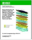
- This multimedia model and report show and describe digital three-dimensional faulted surfaces and volumes of lithologic units that confine and constrain the basin-fill aquifers within the Española Basin of north-central New Mexico. These aquifers are the primary groundwater resource for the cities of Santa Fe and Española, six Pueblo nations, and the surrounding areas. The model presented in this report is a synthesis of geologic information that includes (1) aeromagnetic and gravity data and seismic cross sections; (2) lithologic descriptions, interpretations, and geophysical logs from selected drill holes; (3) geologic maps, geologic cross sections, and interpretations; and (4) mapped faults and interpreted faults from geophysical data. Modeled faults individually or collectively affect the continuity of the rocks that contain the basin aquifers; they also help define the form of this rift basin. Structure, trend, and dip data not previously published were added; these structures are derived from interpretations of geophysical information and recent field observations. Where possible, data were compared and validated and reflect the complex relations of structures in this part of the Rio Grande rift. This interactive geologic framework model can be used as a tool to visually explore and study geologic structures within the Española Basin, to show the connectivity of geologic units of high and low permeability between and across faults, and to show approximate dips of the lithologic units. The viewing software can be used to display other data and information, such as drill-hole data, within this geologic framework model in three-dimensional space.
- Survey Date
- 2011
- Print Date
- 2011
- Height In Inches
- 5.000
- Length In Inches
- 5.500
- Two Sided
- Yes
- Pieces
- 1
- Languages
- English
Related Items


