- Added ROARING SPRINGS, TX to cart. View cart.
- Added VANDERBILT, MI to cart. View cart.
- Added ROSE VALLEY, NE to cart. View cart.
- Added ROSE VALLEY, NE HISTORICAL MAP GEOPDF 7. to cart. View cart.
- Added HANOVER MOUNTAIN, ID HISTORICAL MAP GEOP to cart. View cart.
- Added SARDINE BUTTE, OR to cart. View cart.
- Added CLOVERDALE, MI to cart. View cart.
- Added OPHIR, UT HISTORICAL MAP GEOPDF 7.5X7.5 to cart. View cart.
- Added REIDSVILLE, NC HISTORICAL MAP GEOPDF 7.5 to cart. View cart.
- Added ALDER SPRINGS, CA to cart. View cart.
- Added BLACK ROCK MOUNTAIN, CA to cart. View cart.
- Added NARANJITO, HONDURAS to cart. View cart.
- Added MESCALERO, NM to cart. View cart.
- Added LANGFORD WELL, CA to cart. View cart.
- Added HUNTING SHIRT CREEK, TX to cart. View cart.
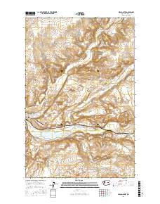
- Added WILSON CREEK RANGE, NV-UT HISTORICAL MAP to cart. View cart.


Product Details
- Product Number
- 83277
- Scale
- 1:100,000
- Alternate ID
- TNV1425
- ISBN
- 978-0-607-40101-1
- Version Date
- 01/01/1982
- Regions
- NV, UT
- Countries
- USA
- Media
- Paper
- Format
- Folded
- Digital Reproduction
- Yes
Additional Details
- Description
- WILSON CREEK RANGE, NV-UT HISTORICAL MAP GEOPDF 30X60 GRID 100000-SCALE 1982
- Survey Date
- 1982
- Print Date
- 1982
- Height In Inches
- 24.100
- Length In Inches
- 41.300
- Boundary Type
- Quadrangle
- Two Sided
- No
- Pieces
- 1
- Languages
- English
Related Items

1:100 000 SCALE TOPOGRAPHIC MAP OF WILSON CREEK RANGE, NEVADA; SURFACE MANAGEMENT STATUS
WILSON CREEK RANGE, NV-UT HISTORICAL MAP GEOPDF 30X60 GRID 100000-SCALE 1982