Product

THE 3D ELEVATION PROGRAM - SUPPORTING OR

$0.00
Available

Product Details

Product Number
534312
Series
FS-2023-3029
Scale
NO SCALE
Alternate ID
FS-2023-3029
Authors
TOM CARLSON
Version Date
08/01/2023
Countries
USA
Media
WEB ONLY
Format
WEB ONLY

Additional Details

Description
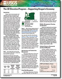
The 3D Elevation Program—Supporting Oregon’s Economy

Fact Sheet 2023-3029

By: Tom Carlson

https://doi.org/10.3133/fs20233029

This product is not available for order, it can only be downloaded from here or within the Publications Warehouse at https://pubs.usgs.gov/publication/fs20233029

For additional information, contact:

Director, National Geospatial Program

https://www.usgs.gov/programs/national-geospatial-program

U.S. Geological Survey

12201 Sunrise Valley Drive, Mail Stop 511

Reston, VA 20192

Email: 3DEP@usgs.gov

Introduction

Oregon’s physical environments and vegetation are diverse. The varied geologic and climatic conditions combined with increasing population have created the need for high-quality elevation data that can be used for infrastructure management, forestry and wildfire management, agriculture, natural resources conservation, and other business uses. Critical applications that meet the State’s management needs depend on light detection and ranging (lidar) data that provide a highly detailed three-dimensional (3D) model of the Earth’s surface and aboveground features.

Survey Date
2023
Print Date
2023
Height In Inches
11.000
Length In Inches
8.500
Languages
English
Related Items
THE 3D ELEVATION PROGRAM - SUPPORTING WA
The 3D Elevation Program—Supporting Washington’s Economy <p> <p> Fact Sheet 2022-3075 <p> National Geospatial Program <p> By: Tom Carlson <p> https://doi.org/10.3133/fs20223075 <p> <p> </p> <font color=red> <p> This product is not available for order, it can only be downloaded from here or within the Publications Warehouse at https://pubs.usgs.gov/publication/fs20223075 </p> </i> </font> <p> <p> For additional information, contact: <p> <p> Director, National Geospatial Program <p> https://www.usgs.gov/programs/national-geospatial-program <p> U.S. Geological Survey <p> 12201 Sunrise Valley Drive, Mail Stop 511 <p> Reston, VA 20192 <p> <p> Email: 3DEP@usgs.gov <p> Introduction <p> <p> Washington State has a geographically diverse and spectacular landscape that is divided to the east and west by the largely volcanic mountains of the Cascade Range. Approximately 88 percent of the population lives in western Washington, mostly in urban areas. The climate is varied, with high precipitation and seasonal flooding in the western part of the State, while drier conditions are found east of the Cascades. Where the terrain is mountainous, the dominant vegetation is coniferous forests, which are prone to frequent seasonal fires. The climate and land use in combination with a dynamic geology result in frequent landslides. Washington has the second highest risk, after California, of large and damaging earthquakes because of its geologic setting. Critical applications that meet the State’s management needs depend on light detection and ranging (lidar) data that provide a highly detailed three-dimensional (3D) model of the Earth’s surface and aboveground features. <p>
FOCUS AREAS FOR POTENTIAL CRITICAL MINER
National Map of Focus Areas for Potential Critical Mineral Resources in the United States <p> Fact Sheet 2023-3007 <p> Prepared in cooperation with the Association of American State Geologists <p> By: Jane M. Hammarstrom, Douglas C. Kreiner, Connie L. Dicken, and Laurel G. Woodruff <p> <p> </p> <font color=red> <p> This product is not available for order, it can only be downloaded from here (click on image) or within the Publications Warehouse at https://pubs.er.usgs.gov/publication/fs20233007 </p> </i> </font> <p> <p> For additional information, contact: <p> Earth Mapping Resources Initiative (Earth MRI) <p> https://www.usgs.gov/special-topics/earth-mri/ <p> Mineral Resources Program <p> U.S. Geological Survey <p> 913 National Center <p> 12201 Sunrise Valley Drive <p> Reston, VA 20192 <p> Email: minerals@usgs.gov <p> <p> Introduction <p> <p> The U.S. Geological Survey (USGS) launched the Earth Mapping Resources Initiative (Earth MRI) to modernize the surface and subsurface geologic mapping of the United States, with a focus on identifying areas that may have the potential to contain critical mineral resources. EarthMRI can inform strategies to ensure secure and reliable domestic critical mineral supplies for the United States as mandated by Executive Order 13817 and the Infrastructure and Jobs Act of 2021 (Public Law 117–58, 135 Stat. 529). Earth MRI is a collaborative effort between the USGS and the State geological surveys as represented by the Association of American State Geologists to identify, prioritize, and acquire new geoscience data for geographic areas, or focus areas, across the Nation that have potential to host critical mineral resources. Mapping of focus areas was based on a framework of mineral systems and their associated mineral deposit types that could possibly host critical minerals. Using readily available geologic, geophysical, geochemical, and mineral deposit data, teams of USGS scientists worked with representatives of State geological surveys in a series of workshops to outline focus areas that contain evidence of key features for one or more mineral systems. These areas can be used to guide future efforts to collect new geologic, geophysical, geochemical, and topographic data that focus on critical minerals through Earth MRI. <p>
LANDFIRE DATA AND APPLICATIONS
<p> LANDFIRE Data and Applications <p> </p> <font color=red><i> <p> This product is not available for order, it can only be downloaded from here (click on image) or within the Publications Warehouse at https://pubs.er.usgs.gov/publication/fs20223034 </p> </i> </font> <p> <p> First posted May 31, 2022 <p> LANDFIRE help desk Earth Resources Observation and Science Center https://www.usgs.gov/centers/eros U.S. Geological Survey 47914 252nd Street Sioux Falls, SD 57198 <p> <p> Abstract <p> <p> LANDFIRE is a Federal program that provides a suite of spatial datasets indicating areas of disturbance, vegetation and fuels distributions and structure, and historical conditions. The level of detail presented in LANDFIRE’s classifications of disturbance, vegetation, and fuels is unparalleled and can be used in a variety of applications, including (1) modeling wildfire risk and fire behavior, (2) modeling habitat and and species ranges, (3) understanding how disturbances affect the landscape, and (4) researching departure from precolonial conditions. Additionally, the all-lands paradigm of LANDFIRE mapping creates spatial data that do not stop at jurisdictional boundaries. The primary research and management applications of LANDFIRE data are detailed in this fact sheet, providing users with a well-rounded understanding of the potential of LANDFIRE’s spatial data layers. <p>