Added TOLTEC MESA-RECONN GEOLOGIC, NM to cart. View cart.


Product Details
- Product Number
- 30710
- Series
- MF-1407
- Scale
- 1:24,000
- Alternate ID
- GMF1407D
- ISBN
- 978-0-607-81048-6
- Authors
- WOBUS, R. A.
- Version Date
- 01/01/1982
- Regions
- NM
- Countries
- USA
- Media
- Paper
- Format
- Folded
Additional Details
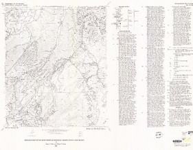
- Description
- Reconnaissance geologic map of the Mule Canyon Quadrangle, Rio Arriba County, New Mexico
- Survey Date
- 1982
- Print Date
- 1982
- Boundary Type
- Quadrangle
- Two Sided
- No
- Pieces
- 1
- Languages
- English
Related Items
Reconnaissance geologic map of the Burned Mountain Quadrangle, Rio Arriba County, New Mexico
Reconnaissance geologic map of the Toltec Mesa Quadrangle, Rio Arriba County, New Mexico