


Product Details
- Product Number
- 21703
- Series
- COAL-34
- Scale
- 1:63,360
- Alternate ID
- GC0034D
- ISBN
- 978-0-607-75876-4
- Authors
- DENSON, N. M.
- Version Date
- 01/01/1955
- Regions
- SD
- Countries
- USA
- Media
- Paper
- Format
- Folded
Additional Details
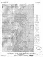
- Description
- Geologic map of Cave Hills and Table Mountain area, Harding County, South Dakota
- Survey Date
- 1955
- Print Date
- 1955
- Boundary Type
- Quadrangle
- Two Sided
- No
- Pieces
- 1
- Languages
- English
Related Items
Geologic map of the southern part of the Slim Buttes area, Harding County, South Dakota
Geologic map of the Bar H area, Slim Buttes, Harding County, South Dakota