


Product Details
- Product Number
- 21706
- Series
- COAL-37
- Scale
- 1:20,000
- Alternate ID
- GC0037D
- ISBN
- 978-0-607-75879-5
- Authors
- ZELLER, H. D.
- Version Date
- 01/01/1955
- Regions
- SD
- Countries
- USA
- Media
- Paper
- Format
- Folded
Additional Details
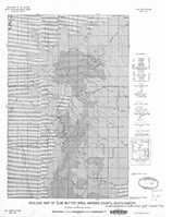
- Description
- Geologic map of the Bar H area, Slim Buttes, Harding County, South Dakota
- Survey Date
- 1955
- Print Date
- 1955
- Boundary Type
- Quadrangle
- Two Sided
- No
- Pieces
- 1
- Languages
- English
Related Items
Geologic map of the southern part of the Slim Buttes area, Harding County, South Dakota
Geologic map of Cave Hills and Table Mountain area, Harding County, South Dakota