Product

ASSESSMENT OF LUNAR RESOURCE EXPLORATION

$0.00
Available

Product Details

Product Number
534318
Series
CIR-1507
Scale
NO SCALE
Alternate ID
21-1507
ISBN
978-1-4113-4515-7
Authors
JOSHUA A COYAN
Version Date
01/01/2022
Media
Paper
Format
Bound

Additional Details

Description
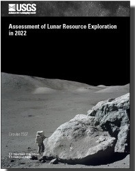
Assessment of Lunar Resource Exploration in 2022

Circular 1507

By: Laszlo P. Keszthelyi, Joshua A. Coyan, Kristen A. Bennett, Lillian R. Ostrach, Lisa R. Gaddis, Travis S. J. Gabriel, and Justin Hagerty

https://doi.org/10.3133/cir1507

First posted May 9, 2023

For additional information, contact:

Astrogeology Research Program staff Astrogeology Science Center

https://www.usgs.gov/centers/astrogeology-science-center/connect

U.S. Geological Survey

https://usgs.gov/

2255 N. Gemini Dr.

Flagstaff, AZ 86001

Abstract

The idea of mining the Moon, once purely science-fiction, is now on the verge of becoming reality. Taking advantage of the resources on the Moon is part of the plans of many nations and some enterprising commercial entities; demonstrating in-situ (in place) resource utilization near the lunar south pole is an explicit goal of the United States’ Artemis program. Economic extraction and sustainable management of these resources require understanding the nature, quantity, and quality of each resource. This publication aims to provide a relatively simple, but technically rigorous, assessment of the status of lunar resource exploration in 2022.

Building on the experience of the U.S. Geological Survey in conducting resource assessments for Earth, we propose a general methodology for quantitative lunar resources assessments. Lunar resources can be categorized as energy, mineral, and water and classified with respect to their certainty and their recoverability. The portion of the technically recoverable resource that can be converted to a commodity within budgetary and other mission constraints can be classified as a "reserve."

For energy resources, solar energy is known to be especially abundant along some high ridges near the lunar poles and the technology to exploit it is mature. Mineral resources, largely in the form of loose rock powder that covers the surface of the Moon, are also widely accessible in large quantities. Many different technologies to convert this material into useful commodities (such as landing pads and oxygen) are currently being developed and are likely to be available for industrial-scale application within 30 years. Water ice almost certainly exists in the polar regions of the Moon but there are fundamental unanswered questions about when and how the ice formed—leaving us without knowledge of the form, quantity, quality, and distribution of lunar ice. Until rover missions bring new ground truth data, lunar ice will remain a highly speculative resource that may be both limited and non-renewable.

Height In Inches
11.000
Length In Inches
8.500
Two Sided
Yes
Pieces
1
Languages
English
Related Items
COOPERATIVE FISH AND WILDLIFE RESEARCH
Cooperative Fish and Wildlife Research Units Program—2022 Year in Review Circular 1505 <p> Cooperative Research Units Program <p> By: Elise Irwin, Donald E. Dennerline, J. Barry Grand, and Jonathan Mawdsley <p> https://doi.org/10.3133/cir1505 <p> <p> First posted February 27, 2023 <p> For additional information, contact: <p> Cooperative Fish and Wildlife Research Units Program <p> https://pubs.usgs.gov/publication/www1.usgs.gov <p> U.S. Geological Survey <p> 12201 Sunrise Valley Drive, Mail Stop 303 <p> Reston, VA 20192 <p> <p> Abstract <p> <p> Established in 1935, the CRU program is a unique cooperative partnership among State Fish and Wildlife agencies, host universities, Wildlife Management Institute, U.S. Geological Survey, and the U.S. Fish and Wildlife Service. Designed to meet the scientific needs of natural resource management agencies and to produce trained wildlife management professionals, the program has grown from the original 9 wildlife-only units to a program that today includes 42 units located on university campuses in 40 States. <p>
VOLCANO HAZARDS PROGRAM, FOR 2022-2026
The Volcano Hazards Program: <p> <p> Strategic Science Plan for 2022 - 2026 <p> <p> Introduction <p> <p> The U.S. Geological Survey (USGS) Volcano Hazards Program (VHP) Strategic Science Plan identifies concrete and realistic goals that advance the VHP’s scientific and operational mission, prioritizes them according to their immediate importance and likelihood of success, and recommends how the VHP can best achieve them, either independently or in collaboration with academic, government, and other partners. The plan addresses goals that share three distinguishing characteristics: innovation, importance, and feasibility over a five-year time scale. Although not stressed here, the important day-to-day operations, which have made the VHP (also referred to as “program”) so successful and effective since its inception, will continue. The new and innovative work proposed below supplements—rather than supplants—the VHP’s existing efforts, which remain essential for fulfilling its primary mission. Pursuing the following major strategic goals will enhance program operations over the next five years: <p>
USGS WILDLAND FIRE SCIENCE STRATEGIC PLN
<p> U.S. Geological Survey Wildland Fire Science Strategic Plan, 2021–26 <p> <p> First posted February 23, 2021 <p> <p> For additional information, contact: Wildland Fire Science Program U.S Geological Survey 12201 Sunrise Valley Drive Reston, VA 20192 <p> Contact Pubs Warehouse: https://pubs.er.usgs.gov/contact <p> <p> Abstract <p> <p> The U.S. Geological Survey (USGS) Wildland Fire Science Strategic Plan defines critical, core fire science capabilities for understanding fire-related and fire-responsive earth system processes and patterns, and informing management decision making. Developed by USGS fire scientists and executive leadership, and informed by conversations with external stakeholders, the Strategic Plan is aligned with the needs of the fire science stakeholder community–fire, land, natural resource, and emergency managers from Federal, State, Tribal, and community organizations, as well as members of the scientific community. The Strategic Plan is composed of four integrated priorities, each with associated goals and specific strategies for accomplishing the goals: Priority 1: Produce state-of-the-art, actionable fire science; Priority 2: Engage stakeholders in science production and science delivery; Priority 3: Effectively communicate USGS fire science capacity, products, and information to a broad audience; and Priority 4: Enhance USGS organizational structure and advance support for fire science. The priorities of this Strategic Plan define the USGS’s commitment to producing and delivering cutting edge fire science, information, and decision-support tools in support of national, regional, and local priorities and stakeholder needs. <p>