Product Details
- Product Number
- 534312
- Series
- FS-2023-3029
- Scale
- NO SCALE
- Alternate ID
- FS-2023-3029
- Authors
- TOM CARLSON
- Version Date
- 08/01/2023
- Countries
- USA
- Media
- WEB ONLY
- Format
- WEB ONLY
Additional Details
- Description
-
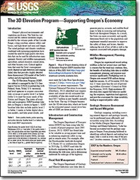
The 3D Elevation Program—Supporting Oregon’s Economy
Fact Sheet 2023-3029
By: Tom Carlson
https://doi.org/10.3133/fs20233029
This product is not available for order, it can only be downloaded from here or within the Publications Warehouse at https://pubs.usgs.gov/publication/fs20233029
For additional information, contact:
Director, National Geospatial Program
https://www.usgs.gov/programs/national-geospatial-program
U.S. Geological Survey
12201 Sunrise Valley Drive, Mail Stop 511
Reston, VA 20192
Email: 3DEP@usgs.gov
Introduction
Oregon’s physical environments and vegetation are diverse. The varied geologic and climatic conditions combined with increasing population have created the need for high-quality elevation data that can be used for infrastructure management, forestry and wildfire management, agriculture, natural resources conservation, and other business uses. Critical applications that meet the State’s management needs depend on light detection and ranging (lidar) data that provide a highly detailed three-dimensional (3D) model of the Earth’s surface and aboveground features.
- Survey Date
- 2023
- Print Date
- 2023
- Height In Inches
- 11.000
- Length In Inches
- 8.500
- Languages
- English


