Product

GEOLOGY AND PALEONTOLOGY OF TULE SPRINGS

$0.00
Available

Product Details

Product Number
534219
Series
FS-2018-3038
Scale
NO SCALE
Alternate ID
FS-2018-3038
Authors
ERIC SCOTT
Version Date
12/01/2018
Countries
USA
Media
WEB ONLY
Format
WEB ONLY

Additional Details

Description

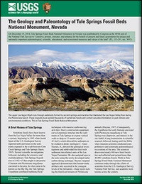
The geology and paleontology of Tule Springs Fossil Beds National Monument, Nevada

This product is not available for order, it can only be downloaded from here (click on image) or within the Publications Warehouse at https://pubs.er.usgs.gov/publication/fs20183038

First posted December 20, 2018

For additional information, contact:

Director, Geosciences and Environmental Change Science Center

http://gec.cr.usgs.gov/

U.S. Geological Survey

Box 25046, MS-980

Denver, CO 80225-0046

Abstract

On December 19, 2014, Tule Springs Fossil Beds National Monument, located in the Las Vegas Valley of southern Nevada, was established by Congress as the 405th unit of the National Park Service to “conserve, protect, interpret, and enhance for the benefit of present and future generations the unique and nationally important paleontological, scientific, educational, and recreational resources and values of the land” (P.L. 113-291, sec. 3092). Vertebrate fossils have been known from the region for more than a century, and recent work has established the Tule Springs local fauna as one of the most significant Pleistocene vertebrate faunas in the American Southwest. The sedimentary sequence that entombs the fossils represents a paleohydrologic system that responded dynamically to abrupt changes in climate throughout the late Quaternary. Work in Tule Springs Fossil Beds National Monument continues today through the efforts of scientists from the U.S. Geological Survey, National Park Service, and academic institutions across the country.

Survey Date
2018
Print Date
2018
Height In Inches
11.000
Length In Inches
8.500
Languages
English
Related Items
REDUCE IMPACTS FROM DANGEROUS VOLCANOES
<p> Indonesia and the United States Team up to Reduce Impacts from Dangerous Volcanoes <p> </p> <font color=red><i> <p> This product is not available for order, it can only be downloaded from here (click on image) or within the Publications Warehouse at https://pubs.er.usgs.gov/publication/fs20193074 </p> </i> </font> <p> <p> First posted April 17, 2020 <p> For additional information, contact: Contact Information Volcano Science Center - Menlo Park U.S. Geological Survey 345 Middlefield Road, MS 910 Menlo Park, CA 94025 <p> <p> Abstract <p> With 75 historically active volcanoes, Indonesia is the world’s most volcanically active nation. Its volcanoes are legendary throughout the world, with the notorious 19th-century eruptions at Mount Tambora (1815) and Krakatau (1883), and the eruption that created the giant Toba Caldera in Sumatra (75,000 years ago)—the Earth’s largest volcanic eruption in the past 100,000 years. Just in the past 20 years, more than 36 volcanoes have erupted, some multiple times, threatening millions of people. The Government of Indonesia responds to this daunting volcanic threat from Indonesia’s Center for Volcanology and Geologic Hazards Mitigation (CVGHM) offices in Bandung. From there, dozens of staff members coordinate operations at 77 small observatories spread out across the 5,000-kilometer-long archipelago that is Indonesia. For more than 50 years, the United States has worked in partnership with the Government of Indonesia to reduce the risk of volcanic eruptions and to save lives. Today, the two governments cooperate through an agreement between CVGHM and the U.S. Geological Survey’s Volcano Disaster Assistance Program (VDAP). Each year CVGHM and VDAP representatives convene to discuss priorities for the upcoming 12 months. They outline a series of training efforts, field campaigns, equipment deployments, and timely topics that require further exploration and development. <p>
MENGURANGI DAMPAK BAHAYA LETUSAN GUNUNG
<p> Indonesia and the United States Team up to Reduce Impacts from Dangerous Volcanoes <p> </p> <font color=red><i> <p> This product is not available for order, it can only be downloaded from here (click on image) or within the Publications Warehouse at https://pubs.er.usgs.gov/publication/fs20193074 </p> </i> </font> <p> <p> First posted April 17, 2020 <p> For additional information, contact: Contact Information Volcano Science Center - Menlo Park U.S. Geological Survey 345 Middlefield Road, MS 910 Menlo Park, CA 94025 <p> <p> Abstract <p> With 75 historically active volcanoes, Indonesia is the world’s most volcanically active nation. Its volcanoes are legendary throughout the world, with the notorious 19th-century eruptions at Mount Tambora (1815) and Krakatau (1883), and the eruption that created the giant Toba Caldera in Sumatra (75,000 years ago)—the Earth’s largest volcanic eruption in the past 100,000 years. Just in the past 20 years, more than 36 volcanoes have erupted, some multiple times, threatening millions of people. The Government of Indonesia responds to this daunting volcanic threat from Indonesia’s Center for Volcanology and Geologic Hazards Mitigation (CVGHM) offices in Bandung. From there, dozens of staff members coordinate operations at 77 small observatories spread out across the 5,000-kilometer-long archipelago that is Indonesia. For more than 50 years, the United States has worked in partnership with the Government of Indonesia to reduce the risk of volcanic eruptions and to save lives. Today, the two governments cooperate through an agreement between CVGHM and the U.S. Geological Survey’s Volcano Disaster Assistance Program (VDAP). Each year CVGHM and VDAP representatives convene to discuss priorities for the upcoming 12 months. They outline a series of training efforts, field campaigns, equipment deployments, and timely topics that require further exploration and development. <p>
EDMAP TRAINING THE NEXT GENERATION
<p> U.S. Geological Survey EDMAP Program—Training the Next Generation of of Geologic Mappers <p> </p> <font color=red><i> <p> This product is not available for order, it can only be downloaded from here (click on image) or within the Publications Warehouse at https://pubs.er.usgs.gov/publication/fs20193059 </p> </i> </font> <p> <p> First posted December 18, 2019 <p> Revised July 14, 2020 <p> For additional information, contact: Director National Cooperative Geologic Mapping Program U.S. Geological Survey 12201 Sunrise Valley Drive Mail Stop 908 Reston, Virginia 20192 <p> <p> Abstract <p> Detailed geologic maps are the basis of nearly every Earth-science investigation and can be used for natural hazard mitigation, resource identification and exploration, infrastructure planning, and more. A component of the congressionally mandated National Cooperative Geologic Mapping Program, EDMAP is a partnership among the U.S. Geological Survey, the Association of American State Geologists, and participating colleges and universities that provides mentorship and training opportunities to geology students nationwide. Under the the guidance of a faculty member, EDMAP supports upper level undergraduate and graduate students to gain meaningful experience on 1-year geologic-mapping projects. Between 1996 and 2019, EDMAP funded research projects for more than 1,200 students at more than 160 universities. Every Federal dollar awarded through the EDMAP program is matched by the student’s university. <p>