

Product Details
- Product Number
- 534124
- Series
- FS-2019-3074
- Scale
- NO SCALE
- Alternate ID
- FS-2019-3074
- Authors
- DAVID W RAMSEY
- Version Date
- 04/01/2019
- Countries
- USA
- Media
- WEB ONLY
- Format
- WEB ONLY
Additional Details
- Description
-
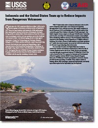
Indonesia and the United States Team up to Reduce Impacts from Dangerous Volcanoes
This product is not available for order, it can only be downloaded from here (click on image) or within the Publications Warehouse at https://pubs.er.usgs.gov/publication/fs20193074
First posted April 17, 2020
For additional information, contact: Contact Information Volcano Science Center - Menlo Park U.S. Geological Survey 345 Middlefield Road, MS 910 Menlo Park, CA 94025
Abstract
With 75 historically active volcanoes, Indonesia is the world’s most volcanically active nation. Its volcanoes are legendary throughout the world, with the notorious 19th-century eruptions at Mount Tambora (1815) and Krakatau (1883), and the eruption that created the giant Toba Caldera in Sumatra (75,000 years ago)—the Earth’s largest volcanic eruption in the past 100,000 years. Just in the past 20 years, more than 36 volcanoes have erupted, some multiple times, threatening millions of people. The Government of Indonesia responds to this daunting volcanic threat from Indonesia’s Center for Volcanology and Geologic Hazards Mitigation (CVGHM) offices in Bandung. From there, dozens of staff members coordinate operations at 77 small observatories spread out across the 5,000-kilometer-long archipelago that is Indonesia. For more than 50 years, the United States has worked in partnership with the Government of Indonesia to reduce the risk of volcanic eruptions and to save lives. Today, the two governments cooperate through an agreement between CVGHM and the U.S. Geological Survey’s Volcano Disaster Assistance Program (VDAP). Each year CVGHM and VDAP representatives convene to discuss priorities for the upcoming 12 months. They outline a series of training efforts, field campaigns, equipment deployments, and timely topics that require further exploration and development.
- Survey Date
- 2019
- Print Date
- 2019
- Height In Inches
- 11.000
- Length In Inches
- 8.500
- Languages
- Indonesian


