Product

CIVIL APPLICATIONS COMMITTEE

$0.00
Available

Product Details

Product Number
534153
Series
FS-2022-3002
Scale
NO SCALE
Alternate ID
FS-2022-3002
Authors
DANIEL W OPSTAL
Version Date
02/01/2022
Countries
USA
Media
WEB ONLY
Format
WEB ONLY

Additional Details

Description

Civil Applications Committee

This product is not available for order, it can only be downloaded from here (click on image) or within the Publications Warehouse at https://pubs.er.usgs.gov/publication/fs20223002

First posted January 27, 2022

Revised February 4, 2022

For additional information, contact: CAC Secretariat National Land Imaging Program https://www.usgs.gov/programs/national-land-imaging-program U.S. Geological Survey 12201 Sunrise Valley Drive, MS 562 Reston, VA 20192

Abstract

The interagency Civil Applications Committee (CAC) facilitates the appropriate civil uses of overhead remote sensing technologies and data collected by military and intelligence capabilities, including from commercial sources. The CAC is operated and staffed by the U.S. Geological Survey on behalf of the U.S. Department of the Interior and its interagency partners. The director of the U.S. Geological Survey is is the chair of the committee, and the vice-chair is a non-Department of the Interior senior official. The CAC ensures certain Federal civil agencies have access to these remotely sensed assets to meet their statutory missions in ways that do not threaten the civil rights, civil liberties, and personal privacy of U.S. citizens. To meets its mandate, the CAC hosts various working groups and communities of interest including those focused on thermal issues (wildland fires and volcanoes), environmental security, and historical satellite imagery.

Survey Date
2022
Print Date
2022
Height In Inches
11.000
Length In Inches
8.500
Languages
English
Related Items
THE USGS LAND REMOTE SENSING PROGRAM
The U.S. Geological Survey Land Remote Sensing Program
NATIONAL CIVIL APPLICATIONS CENTER
National Civil Applications Center <p> Fact Sheet 2022-3085 <p> National Land Imaging Program <p> By: Paul M. Young <p> <p> <p> <font color=red> This product is not available for order, it can only be downloaded from here (click on image) or within the Publications Warehouse at https://pubs.er.usgs.gov/publication/fs20223085 </p> </i> </font> <p> For additional information, contact: <p> Director, National Civil Applications Center <p> U.S. Geological Survey <p> https://www.usgs.gov/ <p> 12201 Sunrise Valley Drive, MS 562 <p> Reston, VA 20192 <p> Email: cac@usgs.gov <p> <p> Abstract <p> <p> The U.S. Geological Survey (USGS) National Civil Applications Center (NCAC) analyzes remote-sensing data from the Intelligence Community (IC) and the U.S. Department of Defense (DOD) to support public safety missions and to study land-surface and environmental changes. The NCAC provides remotely sensed images to USGS scientists and other civilian Federal agencies; the images come from intelligence and military sensors, referred to as U.S. National Imagery Systems (USNIS), and unclassified commercial satellite data purchased by the DOD. Often these data are referred to as Geospatial Intelligence (GEOINT), which is defin ed in U.S. Code, title 10, section 467 as “the exploitation and analysis of imagery and geospatial information to describe, assess, and visually depict physical features and geographically referenced activities on or about the earth. Geospatial intelligence consists of imagery, imagery intelligence, and geospatial information.” The NCAC also provides the secretariat with staff and manages the U.S. interagency Civil Applications Committee (CAC), which oversees and facilitates the appropriate civilian uses of overhead remote-sensing technology and data collected by military and intelligence systems and commercial sources. Funded by the USGS National Land Imaging Program, the NCAC operates facilities in Reston, Virginia, and Lakewood, Colorado. <p>
THE USGS NATIONAL WATER DASHBOARD
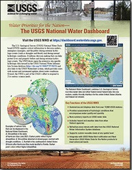
<p> Water Priorities for the Nation—The USGS National Water Dashboard <p> </p> <font color=red><i> <p> This product is not available for order, it can only be downloaded from here (click on image) or within the Publications Warehouse at https://pubs.er.usgs.gov/publication/fs20223003 </p> </i> </font> <p> <p> First posted March 2, 2022 <p> For additional information, contact: Associate Director, Water Resources Mission Area https://www.usgs.gov/mission-areas/water-resources U.S. Geological Survey 12201 Sunrise Valley Drive Reston, VA 20192 <p> <p> Abstract <p> <p> The U.S. Geological Survey National Water Dashboard supplies critical information to decision makers, emergency managers, and the public during extreme hydrologic events (such as droughts and floods) and during normal hydrologic conditions. It informs decision making that can help protect lives and property before and during extreme hydrologic events. The National Water Dashboard draws upon the extensive site-specific hydrologic data housed in the U.S. Geological Survey National Water Information System database (https://doi.org/10.5066/F7P55KJN) and also links to the U.S. Geologic Survey WaterAlert system, which provides users with instant and customized updates about water conditions. Overall, the National Water Dashboard is part of the U.S. Geological Survey's effort to respond to 21st century science needs. <p>