
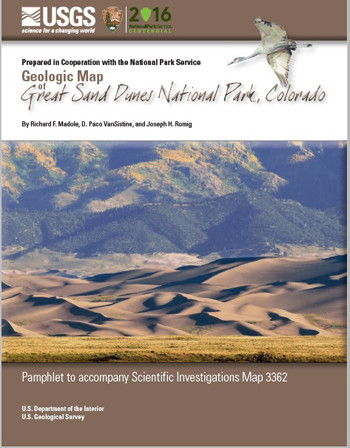
GEOLOGIC MAP GREAT SAND DUNES NP, CO

Product Details
- Product Number
- 518952
- Series
- SIM-3362
- Scale
- 1:35,000
- Alternate ID
- SIM3362
- ISBN
- 978-1-4113-4072-5
- Authors
- D PACO VANSISTINE
- Version Date
- 25/07/2016
- Regions
- CO
- Countries
- USA
- Media
- Paper
- Format
- Folded
Additional Details
- Description
-
Abstract
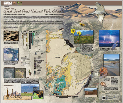
Geologic mapping was begun after a range fire swept the area of what is now the Great Sand Dunes National Park in April 2000. The park spans an area of 437 square kilometers (or about 169 square miles), of which 98 percent is blanketed by sediment of Quaternary age, the Holocene and Pleistocene Epochs; hence, this geologic map of the Great Sand Dunes National Park is essentially a surficial geologic map. These surficial deposits are diverse and include sediment of eolian (windblown), alluvial (stream and sheetwash), palustrine (wetlands and marshes), lacustrine (lake), and mass-wasting (landslides) origin. Sediment of middle and late Holocene age, from about 8,000 years ago to the present, covers about 80 percent of the park.
Fluctuations in groundwater level during Holocene time caused wetlands on the nearby lowland that bounds the park on the west to alternately expand and contract. These fluctuations controlled the stability or instability of eolian sand deposits on the downwind (eastern) side of the lowland. When groundwater level rose, playas became lakes, and wet or marshy areas formed in many places. When the water table rose, spring-fed streams filled their channels and valley floors with sediment. Conversely, when groundwater level fell, spring-fed streams incised their valley floors, and lakes, ponds, and marshes dried up and became sources of windblown sand.
Discharge in streams draining the west flank of the Sangre de Cristo Range is controlled primarily by snowmelt and flow is perennial until it reaches the mountain front, beyond which streams begin losing water at a high rate as the water soaks into the creek beds. Even streams originating in the larger drainage basins, such as Sand and Medano Creeks, generally do not extend much more than 4 km (about 2.5 miles) beyond where they exit the mountains.
The Great Sand Dunes contain the tallest dunes (maximum height about 750 feet, or 230 m) in North America. These dunes cover an area of 72 square kilometers (28 square miles) and contain an estimated 10–13 billion cubic meters (2.4 to 3.1 cubic miles) of sand. The dunes accumulated in an embayment that formed where the trend of the Sangre de Cristo Range changes from southeasterly to southwesterly. They owe their exceptional height to a combination of factors including range-front geometry, topography, an abundant sand supply from the nearby basin, a complex wind regime, and the Sangre de Cristo Range, which prevents continued eastward migration of dune sand deposited by the prevailing southwesterly and westerly winds. Although the sand on the surface of the Great Sand Dunes is of late Holocene age, most of this massive sand body is a complex of deposits that accumulated episodically for more than 130,000 years.
- Survey Date
- 2016
- Print Date
- 2017
- Length In Inches
- 4.640
- Two Sided
- No
- Pieces
- 2
- Languages
- English


