


Product Details
- Product Number
- 302230
- Scale
- 1:250,000
- Version Date
- 01/01/1953
- Regions
- LA, TX
- Countries
- USA
- Media
- Paper
- Format
- Flat
Additional Details
- Description
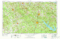
- PALESTINE, TX-LA HISTORICAL MAP GEOPDF 1X2 GRID 250000-SCALE 1953
- Survey Date
- 1953
- Print Date
- 1964
- Height In Inches
- 22.100
- Length In Inches
- 33.700
- Boundary Type
- Quadrangle
- Pieces
- 1
Related Items
PALESTINE, TX-LA HISTORICAL MAP GEOPDF 1X2 GRID 250000-SCALE 1953