


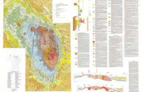
Product Details
- Product Number
- 28059
- Series
- I-1906
- Scale
- 1:50,000
- Alternate ID
- GI1906D
- ISBN
- 978-0-607-79054-2
- Authors
- THOMPSON, REN A.
- Version Date
- 01/01/1989
- Regions
- CO
- Countries
- USA
- Media
- Paper
- Format
- Folded
Additional Details
- Description
- Geologic Investigations Map 208458 I-1906, Geologic Map of the San Luis Quadrangle, Costilla County, Colorado, 1:24,000 scale is also available, and covers a smaller Geologic area.
- Survey Date
- 1989
- Print Date
- 1989
- Height In Inches
- 33.750
- Length In Inches
- 54.000
- Boundary Type
- Quadrangle
- Two Sided
- No
- Pieces
- 1
- Languages
- English
Related Items

Geologic Map of the San Luis Quadrangle, Costilla County, Colorado
Geologic map of the Black Hills area, South Dakota and Wyoming