Product Details
- Product Number
- 252994
- Series
- OFR-01-436
- Scale
- NO SCALE
- Alternate ID
- 010436
- Authors
- A D FRANKEL
- Version Date
- 01/01/2001
- Countries
- USA
- Media
- Paper
- Format
- Printed but Unbound
- Digital Reproduction
- Yes
Additional Details
- Description
-
Abstract:
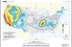
The U.S. Geological Survey (USGS) recently completed new probabilistic seismic hazard maps for the United States. The hazard maps form the basis of the probabilistic component of the design maps used in the 2000 International Building Code (International Code Council, 2000a), 2000 International Residential Code (International Code Council, 2000a), 1997 NEHRP Recommended Provisions for Seismic Regulations for New Buildings (Building Seismic Safety Council, 1997), and 1997 NEHRP Guidelines for the Seismic Rehabilitation of Buildings (Applied Technology Council, 1997). The probabilistic maps depict peak horizontal ground acceleration and spectral response at 0.2, 0.3, and 1.0 sec periods, with 10%, 5%, and 2% probabilities of exceedance in 50 years, corresponding to return times of about 500, 1000, and 2500 years, respectively. This report is a user guide for a CD-ROM that has been prepared to allow the determination of probabilistic map values by latitude-longitude or zip code. The CD includes additional spectral accelerations at 0.1, 0.5, and 2.0 sec for the 48 conterminous states. The CD also contains hazard curve data that were used to prepare the maps. Hazard curves may also be determined by latitude-longitude or zip code.
- Height In Inches
- 11.000
- Length In Inches
- 8.500
- Two Sided
- Yes
- Pieces
- 1
- Languages
- English


