


Product Details
- Product Number
- 24828
- Series
- GQ-1749
- Scale
- 1:24,000
- Alternate ID
- GGQ1749D
- ISBN
- 978-0-607-75773-6
- Authors
- LIPMAN, PETER W.
- Version Date
- 01/01/1994
- Regions
- CO, NM
- Countries
- USA
- Media
- Paper
- Format
- Folded
Additional Details
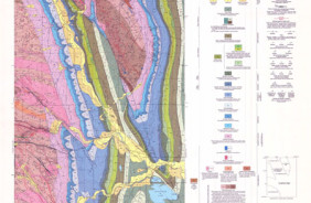
- Description
- Geologic map of the Los Pinos quadrangle, Rio Arriba and Taos Counties, New Mexico and Conejos County, Colorado
- Survey Date
- 1994
- Print Date
- 1994
- Boundary Type
- Quadrangle
- Two Sided
- No
- Pieces
- 1
- Languages
- English
Related Items
Geologic map of the San Antonio Mountain quadrangle, Rio Arriba County, New Mexico
Geologic map of Bernalillo NW quadrangle, Sandoval County, New Mexico
Geologic map of the Masonville quadrangle, Larimer County, Colorado