


KIT, FLOOD INUNDATION KALAMAZOO RIVER
$77.00
Available
View/Download Free PDF

Product Details
- Product Number
- 244633
- Series
- SIM-3135
- Scale
- NO SCALE
- Alternate ID
- SIM3135
- Authors
- CHAD D MENKE
- Version Date
- 01/01/2010
- Regions
- MI
- Countries
- USA
- Media
- Paper
- Format
- Printed but Unbound
Additional Details
- Description
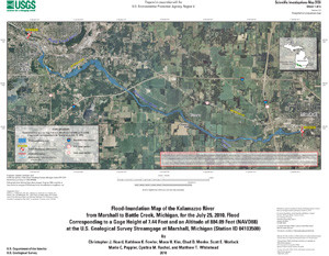
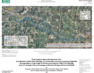
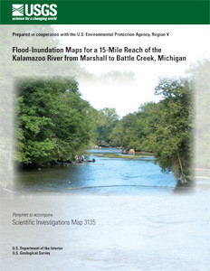
- Digital flood-inundation maps for a 15-mile reach of the Kalamazoo River from Marshall to Battle Creek, Michigan, were created by the U.S. Geological Survey (USGS) in cooperation with the U.S. Environmental Protection Agency to help guide remediation efforts following a crude-oil spill on July 25, 2010. The spill happened on Talmadge Creek, a tributary of the Kalamazoo River near Marshall, during a flood. The floodwaters transported the spilled oil down the Kalamazoo River and dep osited oil in impoundments and on the surfaces of islands and flood plains. Six flood-inundation maps were constructed corresponding to the flood stage (884.09 feet) coincident with the oil spill on July 25, 2010, as well as for floods with annual exceedance probabilities of 0.2, 1, 2, 4, and 10 percent. Streamflow at the USGS streamgage at Marshall, Michigan (USGS site ID 04103500), was used to calculate the flood probabilities. From August 13 to 18, 2010, 35 channel cross sections, 17 bridges and 1 dam were surveyed. These data were used to construct a water-surface profile for the July 25, 2010, flood by use of a one-dimensional step-backwater model. The calibrated model was used to estimate water-surface profiles for other flood probabilities. The resulting six flood-inundation maps were created with a geographic information system by combining flood profiles with a 1.2-foot vertical and 10-foot horizontal resolution digital elevation model derived from Light Detection and Ranging data.
- Two Sided
- No
- Pieces
- 7
- Languages
- English
Related Items

Flood-Inundation Maps for a 15-Mile Reach of the Kalamazoo River from Marshall to Battle Creek, Michigan
Flood-Inundation Maps for a 15-Mile Reach of the Kalamazoo River from Marshall to Battle Creek, Michigan sheet 1 of 6
Flood-Inundation Maps for a 15-Mile Reach of the Kalamazoo River from Marshall to Battle Creek, Michigan sheet 2 of 6
Flood-Inundation Maps for a 15-Mile Reach of the Kalamazoo River from Marshall to Battle Creek, Michigan sheet 3 of 6