


Product Details
- Product Number
- 243067
- Series
- SIR-2010-5127
- Scale
- NO SCALE
- Alternate ID
- SIR-2010-5127
- ISBN
- 978-1-4113-2947-8
- Authors
- ROBERT H FLYNN
- Version Date
- 01/01/2010
- Regions
- NH
- Countries
- USA
- Media
- Paper
- Format
- Bound
Additional Details
- Description
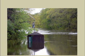
- On May 15, 2006, a breach in the riverbank caused an avulsion in the Suncook River in Epsom, NH. The breach in the riverbank and subsequent avulsion changed the established flood zones along the Suncook River; therefore, a new flood study was needed to reflect this change and aid in flood recovery and restoration. For this flood study, the hydrologic and hydraulic analyses for the Suncook River were conducted by the U.S. Geological Survey, in cooperation with the Federal Emergency Management Agency. This report presents water-surface elevations and profiles determined using the U.S. Army Corps of Engineers one-dimensional Hydrologic Engineering Center River Analysis System model, also known as HEC-RAS. Steady-state water-surface profiles were developed for the Suncook River from its confluence with the Merrimack River in the Village of Suncook (in Allenstown and Pembroke, NH) to the upstream corporate limit of the town of Epsom, NH (approximately 15.9 river miles). Floods of magnitudes that are expected to be equaled or exceeded once on the average during any 2-, 5-, 10-, 25-, 50-, 100-, or 500-year period (recurrence interval) were modeled using HEC-RAS. These flood events are referred to as the 2-, 5-, 10-, 25-, 50-, 100-, and 500-year floods and have a 50-, 20-, 10-, 4-, 2-, 1-, and 0.2-percent chance, respectively, of being equaled or exceeded during any year. The 10-, 50-, 100-, and 500-year flood events are important for flood-plain management, determination of flood-insurance rates, and design of structures such as bridges and culverts. The analyses in this study reflect flooding potentials that are based on existing conditions in the communities of Epsom, Pembroke, and Allenstown at the time of completion of this study (2009). Changes in the 100-year recurrence-interval flood elevation from the 1979 flood study were typically less than 2 feet with the exception of a location 900 feet upstream from the avulsion that, because of backwater from the dams in the abandoned channel, was 12 feet higher in the 1979 flood study than in this study.
- Survey Date
- 2010
- Print Date
- 2010
- Height In Inches
- 11.000
- Width In Inches
- 0.250
- Length In Inches
- 8.500
- Two Sided
- Yes
- Pieces
- 1
- Languages
- English
Related Items
Estimation of Flood Discharges at Selected Recurrence Intervals for Streams in New Hampshire

Observed and Forecast Flood-Inundation Mapping Application: A Pilot Study of an Eleven-Mile Reach of the White River, Indianapolis, Indiana