Product Details
- Product Number
- 212344
- Series
- FS-2009-3053
- Scale
- NO SCALE
- Alternate ID
- FS2009-3053
- Version Date
- 07/01/2009
- Countries
- USA
- Media
- Paper
- Format
- Folded
Additional Details
- Description
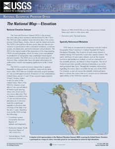
- 7/15/2009 Abstract The National Elevation Dataset (NED) is the primary elevation data product produced and distributed by the USGS. The NED provides seamless raster elevation data of the conterminous United States, Alaska, Hawaii, and the island territories. The NED is derived from diverse source data sets that are processed to a specification with a consistent resolution, coordinate system, elevation units, and horizontal and vertical datums. The NED is the logical result of the maturation of the long-standing USGS elevation program, which for many years concentrated on production of topographic map quadrangle-based digital elevation models. The NED serves as the elevation layer of The National Map, and provides basic elevation information for earth science studies and mapping applications in the United States. The NED is a multi-resolution dataset that is updated bimonthly to integrate newly available, improved elevation source data. NED data are available nationally at grid spacings of 1 arc-second (approximately 30 meters) for the conterminous United States, and at 1/3 and 1/9 arc-seconds (approximately 10 and 3 meters, respectively) for parts of the United States. Most of the NED for Alaska is available at 2-arc-second (about 60 meters) grid spacing, where only lower resolution source data exist. Part of Alaska is available at the 1/3-arc-second resolution, and plans are in development for a significant upgrade in elevation data coverage of the State over the next 5 years. Specifications for the NED include the following: *Coordinate system: Geographic (decimal degrees of latitude and longitude), *Horizontal datum: North American Datum of 1983 (NAD 83), *Vertical datum: North American Vertical Datum of 1988 (NAVD 88) over the conterminous United States and varies in other areas, and *Elevation units: Decimal meters.
- Survey Date
- 2009
- Print Date
- 2009
- Height In Inches
- 11.000
- Length In Inches
- 8.500
- Two Sided
- Yes
- Pieces
- 1
- Languages
- English
Related Items


