
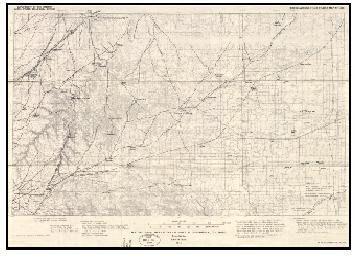
HISTORIC TRAIL MAP OF LA JUNTA QUAD, CO

Product Details
- Product Number
- 208800
- Series
- SIM-2923
- Scale
- 1:250,000
- Alternate ID
- SIM2923
- ISBN
- 978-1-4113-2037-6
- Authors
- GLENN R SCOTT
- Version Date
- 01/01/2008
- Regions
- CO, KS
- Countries
- USA
- Media
- Paper
- Format
- Flat
Additional Details
- Description
-
This historic trail map of the La Junta quadrangle contains all or part of eight Colorado and Kansas counties. Many of the historic trails in the La Junta quadrangle were used by Indians long before the white man reached the area. The earliest recorded use of the trails by white men in the quadrangle was in the 1820s when traders brought goods from St. Louis for barter with the Indians and for commerce with the Mexican settlements in New Mexico.
The map and accompanying pamphlet include an introduction and the method of preparation used by the authors. The pamphlet includes a description of the early explorers along the Arkansas River and on the Santa Fe Trail, as well as roads established or proposed under General Assembly session law, Colorado Territorial corporations and charters, 1859–1876, and freighting companies. Stage companies that probably operated in the La Junta quadrangle also are described. The authors include a section on railroads in the quadrangle and north of the quadrangle along the Arkansas River.
Military and civilian camps, forts, and bases are reported. Moreover, fossils and plants in the quadrangle are described. Indian tribes—Early Man or paleo-Indians, Archaic Indians, prehistoric and historic Indians, and historic Indian tribes in the quadrangle—are reported. Authors include place names within and along freight routes leading to the La Junta quadrangle.
A full description of the contents along with three figures can be found in the Introduction.
- Survey Date
- 2008
- Print Date
- 2004
- Height In Inches
- 40.000
- Length In Inches
- 56.000
- Boundary Type
- Quadrangle
- Two Sided
- No
- Pieces
- 2
- Languages
- English


