


Product Details
- Product Number
- 208451
- Series
- DS-344
- Scale
- NO SCALE
- Alternate ID
- DS-344
- Authors
- UNIVERSITY OF NEW ORLEANS
- Version Date
- 01/01/2008
- Regions
- LA
- Countries
- USA
- Media
- Electronic (Physical)
- Format
- CD-ROM
Additional Details
- Description
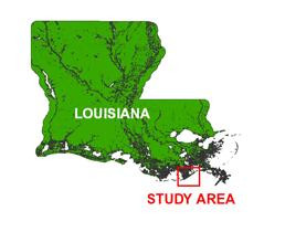
- Project Summary In 2000, the U.S. Geological Survey (USGS), in cooperation with the University of New Orleans (UNO) and the U.S. Army Corps of Engineers (USACE), conducted geologic surveys in Barataria Bight from Sandy Point to Belle Pass, LA (Study Area Map). Sediment cores were collected as part of the USGS Subsidence and Coastal Change (SCC) Project, which included the Barataria Sand-Resource Study (bss) vibracore surveys (Kindinger and others, 2001). This report also contains information from other cruise data sets, including the Cheniere Ronquille, LA, data (CR83) and the Plaquemines, LA, data (P86). The sediment data for these cruises were obtained by the Louisiana Geological Survey (LGS), the Louisiana Department of Natural Resources (LDNR), and Alpine Ocean Seismic Survey, Inc., as part of the near shore sand resource inventory of "Louisiana Sand Resource Inventory 1985 Vibracore Services" (Suter and others, 1991; Alpine Ocean Seismic Survey, Inc., 1986). Additionally, this report also includes the U.S. Army Corps of Engineers EUSTIS borehole cores (B-#). EUSTIS is the type of drill rig used to obtain the borehole cores and is used as name identifier for the USACE borehole cores presented herein.
- Height In Inches
- 5.500
- Length In Inches
- 5.000
- Pieces
- 1
Related Items
Archive of Digital CHIRP Seismic Reflection Data Collected During USGS Cruise 06SCC03 Offshore of Cheniere Caminada, Louisiana, July 2006
Archive of Digital Chirp Sub-bottom Profile Data Collected During USGS Cruise 09CCT01 Offshore of Sabine Pass and Galveston, Texas, March 2009
Archive of Digital Chirp Sub-bottom Profile Data Collected During USGS Cruise 07SCC01 Offshore of the Chandeleur Islands, Louisiana, June 2007