
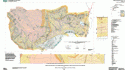
BEDROCK GEOLOGIC MAP OF THE HUBBARD
$75.00
Available

Product Details
- Product Number
- 116740
- Series
- OFR-00-45-A
- Scale
- NO SCALE
- Alternate ID
- 000045A
- Authors
- ARMSTRONG, THOMAS R.
- Version Date
- 01/01/2000
- Regions
- NH
- Countries
- USA
- Media
- Paper
- Format
- Flat
- Digital Reproduction
- Yes
Additional Details
- Description
- 1 oversized sheet 65 x 35, 25pg text SAP#116742. refer to material details for further info
- Height In Inches
- 35.000
- Length In Inches
- 65.000
- Two Sided
- No
- Pieces
- 1
- Languages
- English
Related Items
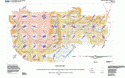
Fracture Map-Bedrock Geologic Map of the Hubbard Brook Experimental Forest, Grafton County, New Hampshire Sht 2, refer to 116740 sht 1

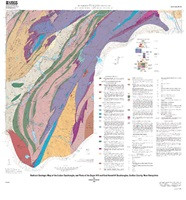
Bedrock geologic map of Hubbard Brook Experimental Forest and maps of fractures and geology in roadcuts along Interstate 93, Grafton County, New Hampshire
Bedrock geologic map of the Lisbon quadrangle, and parts of the Sugar Hill and East Haverhill quadrangles, Grafton County, New Hampshire Open-File Report 2018-1016 Prepared in cooperation with the State of Vermont, Vermont Agency of Natural Resources, Vermont Geological Survey, and the State of New Hampshire, Department of Environmental Services, New Hampshire Geological Survey By: Douglas W. Rankin https://doi.org/10.3133/ofr20181016