Product Details
- Product Number
- 116550
- Series
- SIM-2843
- Scale
- 1:1,000,000
- Alternate ID
- SIM2843
- ISBN
- 978-0-607-92838-9
- Authors
- STRAUB ARTHUR W
- Version Date
- 01/01/2004
- Regions
- ND
- Countries
- USA
- Media
- Paper
- Format
- Folded
Additional Details
- Description
-
Abstract
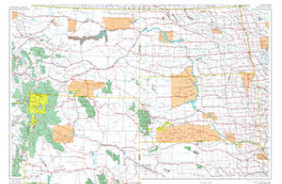
This report is an overview of glacial limits and glacial history on the plains in northern Montana and northeastern North Dakota (long 102?-114?W.) and also in adjacent southern Alberta and Saskatchewan, Canada. In the Rocky Mountains and on the plains adjacent to the mountains in Montana, the map also depicts spatial relations of valley glaciers and piedmont ice lobes to continental ice sheets. Glacial limits east of 102?, in the United States and also in adjacent Canada, are depicted on published maps of the U.S. Geological Survey Quaternary Geologic Atlas of the United States (I-1420) map series. The limits shown here are from data compiled for the Lethbridge, Regina, Yellowstone, and Big Horn Mountains 4? x 6? quadrangles in the Quaternary Geologic Atlas series. This geospatial database has been prepared with a degree of detail appropriate for viewing at a scale of 1:1,000,000. Because of the degree of generalization required, the map is intended for regional analysis, rather than for detailed analysis in specific areas. It depicts the geographic positions of the limits of mountain and continental glaciations and the limits of selected glacial readvances. That information provides a foundation for reconstruction of geologic history and for reconstruction. The base map is simplified. Selected hydrographic features, selected towns and cities, selected physiographic features, and a grid of 1? x 2? topographic quadrangles are included to aid the reader in location of the glacial limits and other features that are depicted here on other maps at different scales. Most of the geologic data were compiled at 1:250,000 scale. The nominal reading scale of the digitized map data is 1:1,000,000. Enlargement will not restore resolution that was lost by simplification or generalization of data. Accompanying illustrations show regional directions of ice movement from Canada into the United States during maximum Illinoian glaciation, during maximum late Wisconsin glaciation, and during a later regional glacial readvance maximum
- Survey Date
- 2004
- Print Date
- 2004
- Height In Inches
- 28.010
- Length In Inches
- 43.510
- Boundary Type
- Quadrangle
- Two Sided
- No
- Pieces
- 2
- Languages
- English