


Product Details
- Product Number
- 109351
- Scale
- 1:100,000
- Alternate ID
- TWV0625
- ISBN
- 978-0-607-60045-2
- Version Date
- 01/01/1982
- Regions
- WV, OH, KY
- Countries
- USA
- Media
- Paper
- Format
- Flat
- Digital Reproduction
- Yes
Additional Details
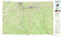
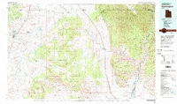
- Description
- HUNTINGTON, WV-KY-OH HISTORICAL MAP GEOPDF 30X60 GRID 100000-SCALE 1982
- Survey Date
- 1982
- Print Date
- 1983
- Height In Inches
- 24.200
- Length In Inches
- 41.400
- Boundary Type
- Quadrangle
- Two Sided
- No
- Pieces
- 1
- Languages
- English
Related Items
HUNTINGTON, WV-KY-OH HISTORICAL MAP GEOPDF 30X60 GRID 100000-SCALE 1982
HUNTINGTON, UT HISTORICAL MAP GEOPDF 30X60 GRID 100000-SCALE 1980
