
UGASHIUK/BRISTOL BAY-GEOCHEM, AK

Geochemical map showing the distribution of selected elements determined in stream sediment from the Ugashik, Bristol Bay, and western Karluk quadrangles, Alaska
ENERGY RESOURCES OF UGASHIK, AK
Mineral and energy resource assessment maps of the Ugashik, Bristol Bay, and western Karluk quadrangles, Alaska
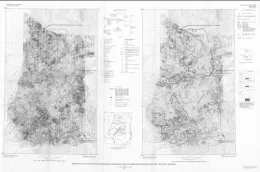
WEST CLEAR CREEK, AEROMAG MAP, AZ
Aeromagnetic map of the West Clear Creek roadless area, Coconino and Yavapai Counties, Arizona
WEST CLEAR CREEK, MIN RES POTE, AZ
Mineral resource potential of the West Clear Creek Roadless Area, Yavapai and Coconino counties, Arizona
VENTANA, MIN RES POTENTIAL, CA
Mineral resource potential map of part of the Ventana Wilderness and the Black Butte, Bear Mountain, and Bear Canyon Roadless Areas, Monterey County, California
WET BEAVER, GEOCHEM MAP, AZ
Geochemical map of the Wet Beaver Roadless Area, Coconino and Yavapai counties, Arizona
GEOCHEM MAPS SAMPLES ROCKS MIN, CA
Summary geochemical maps for samples of rocks, minus-80-mesh stream sediment, and nonmagnetic heavy-mineral concentrate, Kings River, Rancheria, Agnew, and Oat Mountain Roadless Areas, Fresno County, California
GEOLOGIC BURDEN FALLS ROADLESS AREA, IL
Geologic map of the Burden Falls Roadless Area, Pope County, Illinois
LITTLE BLAKELY ROADLESS AREA, AR
Map showing geology and mineral resource potential of the Little Blakely Roadless Area, Garland County, Arkansas
RATTLESNAKE, MIN RES POTENTIAL, AZ
Mineral resource potential and geologic map of the Rattlesnake Roadless Area, Yavapai and Coconino counties, Arizona
AEROMAGNETIC LATIR WHEELER PK, NM
Aeromagnetic maps of the Latir Peak and Wheeler Peak Wildernesses and the Columbine-Hondo Wilderness Study Area, Taos County, New Mexico
ARNOLD MESA, AEROMAG MAP, AZ
Aeromagnetic map of the Arnold Mesa Roadless Area, Yavapai County, Arizona
ARNOLD MESA, MIN RES POTENTIAL, AZ
Mineral resource potential map of the Arnold Mesa Roadless Area, Yavapai County, Arizona
NORTH FORK JOHN DAY RIVER-GEOL, OR
Geologic map of the North Fork John Day River Roadless Area, Grant County, Oregon
MINERAL RESOURCE POTENTIAL NEWTON, AR
Mineral resource potential and geologic map of the Upper Buffalo Wilderness and the Buffalo addition Roadless Areas, Newton County, Arkansas