
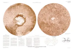
TOPOGRAPHIC CONTOUR MAPS OF MARS
TOPOGRAPHIC AND COLOR-CODED CONTOUR MAPS OF MARS
TOPOGRAPHIC MAPS OF NOVARUPTA DOME

Topographic Maps of Novarupta Dome and Selected Portions of the Valley of Ten Thousand Smokes, Katmai National Park and Preserve, Alaska 4 oversized sheets
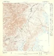
OKMULGEE, OK HISTORICAL TOPOGRAPHIC MAPS
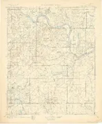
OKMULGEE, OK HISTORICAL TOPOGRAPHIC MAPS 125000-SCALE 1900
OKMULGEE, OK HISTORICAL TOPOGRAPHIC MAPS
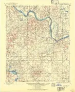
OKMULGEE, OK HISTORICAL TOPOGRAPHIC MAPS 125000-SCALE 1896
TOPOGRAPHIC MAPPING
TOPOGRAPHIC MAPPING
KAPOHO, HI HISTORICAL TOPOGRAPHIC MAPS 2

KAPOHO, HI HISTORICAL TOPOGRAPHIC MAPS 24000-SCALE 1995
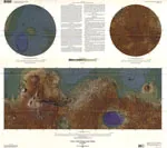
TOPOGRAPHIC MAPS POLAR, WEST, EAST MARS
Topographic maps of the polar, western, and eastern regions of Mars
THE NATIONAL MAP TOPOGRAPHIC MAPS
The National Map: Topographic Maps for the 21st Century
GEOLOGIC & TOPOGRAPHIC MAPS KABUL SOUTH
Geologic and Topographic Maps of the Kabul South 30'× 60' Quadrangle, Afghanistan
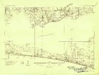
FAJARDO SO, PR HISTORICAL TOPOGRAPHIC MA

FAJARDO SO, PR HISTORICAL TOPOGRAPHIC MAPS 10000-SCALE 1947
NAGUABO SO, PR HISTORICAL TOPOGRAPHIC MA
NAGUABO SO, PR HISTORICAL TOPOGRAPHIC MAPS 10000-SCALE 1947
NAGUABO NE, PR HISTORICAL TOPOGRAPHIC MA
NAGUABO NE, PR HISTORICAL TOPOGRAPHIC MAPS 10000-SCALE 1947
SALINAS SE, PR HISTORICAL TOPOGRAPHIC MA

SALINAS SE, PR HISTORICAL TOPOGRAPHIC MAPS 10000-SCALE 1947
NAGUABO SE, PR HISTORICAL TOPOGRAPHIC MA

NAGUABO SE, PR HISTORICAL TOPOGRAPHIC MAPS 10000-SCALE 1947
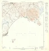
VILLA TASSO, FL HISTORICAL TOPOGRAPHIC M
VILLA TASSO, FL HISTORICAL TOPOGRAPHIC MAPS 48000-SCALE 1935