
- Added SIMEONOF ISLAND D-1, AK to cart. View cart.
- Added ARGILLITE, KY to cart. View cart.
- Added EMERY WEST-GEOL/COAL RESOURCES, UT to cart. View cart.
- Added AEROMAGNETIC MINERAL QUAD, VA to cart. View cart.
- Added JUNEAU A-2 NW, AK to cart. View cart.
- Added DALLAS, TX to cart. View cart.
- Added BALTIMORE WEST, MD to cart. View cart.
- Added BEECHWOOD, MI HISTORICAL MAP GEOPDF 7.5X to cart. View cart.
- Added BAR MILLS, ME to cart. View cart.
- Added WHEELBARROW PEAK/GROOM MINE, NV to cart. View cart.
- Added COLLEGE PEAKS, AZ to cart. View cart.
- Added BANCROFT, WV to cart. View cart.
- Added GEORGETOWN, CA to cart. View cart.
- Added MOUNT DIABLO, CA HISTORICAL MAP GEOPDF 1 to cart. View cart.
- Added SITKA C-7, AK to cart. View cart.
- Added WASHINGTON DC AND VICINITY, DC to cart. View cart.
- Added NORTH GROESBECK, TX-OK HISTORICAL MAP GE to cart. View cart.

Product Details
- Product Number
- 97725
- Scale
- 1:24,000
- Alternate ID
- TTX2648
- ISBN
- 978-0-607-52033-0
- Version Date
- 01/01/1951
- Regions
- OK, TX
- Countries
- USA
- Media
- Paper
- Format
- Flat
- Digital Reproduction
- Yes
Additional Details
- Description
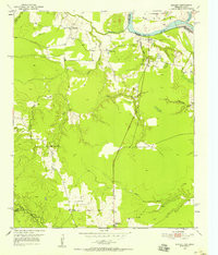
- NEGLEY, TX-OK HISTORICAL MAP GEOPDF 7.5X7.5 GRID 24000-SCALE 1951
- Survey Date
- 1951
- Print Date
- 1958
- Height In Inches
- 26.900
- Length In Inches
- 23.000
- Boundary Type
- Quadrangle
- Two Sided
- No
- Pieces
- 1
- Languages
- English
Related Items

NEW OBERLIN, OK-TX HISTORICAL MAP GEOPDF 7.5X7.5 GRID 24000-SCALE 1980

NORTHSIDE, TX-OK HISTORICAL MAP GEOPDF 7.5X7.5 GRID 24000-SCALE 1985

NORTH GROESBECK, TX-OK HISTORICAL MAP GEOPDF 7.5X7.5 GRID 24000-SCALE 1985