- Added SIMES CREEK, WI to cart. View cart.
- Added FISH SLOUGH, CA to cart. View cart.
- Added SLIDELL, LA-MS to cart. View cart.
- Added MARION, WI to cart. View cart.
- Added ANCHORAGE A-5, AK to cart. View cart.
- Added DAVIS HILL, TX to cart. View cart.
- Added YELLOW DOG PEAK, CA to cart. View cart.
- Added SAL'SK, RUSSIA to cart. View cart.
- Added LIVENGOOD C-2, AK to cart. View cart.
- Added EDWARDS AQUIFER RECHARGE ZONE, TX to cart. View cart.
- Added FAYETTE COUNTY, IL to cart. View cart.
- Added WINFIELD, CO to cart. View cart.
- Added LUDINGTON, MI to cart. View cart.
- Added THELMA, GA to cart. View cart.
- Added EMBARRASS, WI to cart. View cart.
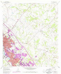
- Added BRYAN EAST, TX to cart. View cart.


Product Details
- Product Number
- 303945
- Scale
- 1:24,000
- Version Date
- 01/01/1971
- Regions
- TX
- Countries
- USA
- Media
- Paper
- Format
- Flat
Additional Details
- Description
- BRYAN EAST, TX HISTORICAL MAP GEOPDF 7.5X7.5 GRID 24000-SCALE 1962
- Survey Date
- 1962
- Print Date
- 1974
- Height In Inches
- 26.800
- Length In Inches
- 23.100
- Boundary Type
- Quadrangle
- Pieces
- 1
Related Items