
- Added DEVILS PUNCHBOWL, CA HISTORICAL MAP GEOP to cart. View cart.
- Added CARTHAGE, AR to cart. View cart.
- Added RATTLESNAKE HILL, MT to cart. View cart.
- Added SEARS DAM, SD HISTORICAL MAP GEOPDF 7.5X to cart. View cart.
- Added ATHENS, GA-SC HISTORICAL MAP GEOPDF 1X2 to cart. View cart.
- Added BREMERTON WEST, WA to cart. View cart.
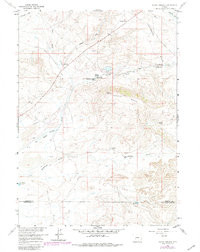
- Added PACIFIC SPRINGS, WY HISTORICAL MAP GEOPD to cart. View cart.


Product Details
- Product Number
- 526883
- Scale
- 1:24,000
- Version Date
- 01/01/1980
- Regions
- WY
- Countries
- USA
- Media
- Paper
- Format
- Flat
Additional Details
- Description
- PACIFIC SPRINGS, WY HISTORICAL MAP GEOPDF 7.5X7.5 GRID 24000-SCALE 1958
- Survey Date
- 1958
- Print Date
- 1980
- Height In Inches
- 26.870
- Length In Inches
- 21.360
- Boundary Type
- Quadrangle
- Pieces
- 1
Related Items
PACIFIC SPRINGS, WY HISTORICAL MAP GEOPDF 7.5X7.5 GRID 24000-SCALE 1958