
- Added TIN DEPOSITS NORTHERN LANDER COUNTY, NV to cart. View cart.
- Added PACIFIC VALLEY, CA to cart. View cart.
- Added ELLIS COUNTY, KS to cart. View cart.
- Added AEROMAGNETIC AUSTIN AREA, LANDER NEVADA to cart. View cart.
- Added INVESTIGATIONS AMERICAN REPUBLICS 1944-5 to cart. View cart.
- Added GEOLOGY URANIUM DEPOSITS FRONT RANGE, CO to cart. View cart.
- Added YAKUTAT B-2 NW, AK to cart. View cart.
- Added URANIUM-BEARING COAL GREAT DIVIDE, WY to cart. View cart.
- Added WAGRAM, NC to cart. View cart.
- Added HEISE, ID to cart. View cart.
- Added WARSAW, AL to cart. View cart.
- Added CLAYTON, NC to cart. View cart.
- Added WHITE ROCK CANYON, NV to cart. View cart.
- Added SPOT MOUNTAIN, ID to cart. View cart.
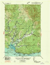
- Added GRAYS RIVER, WA-OR HISTORICAL MAP GEOPDF to cart. View cart.

Product Details
- Product Number
- 924260
- Scale
- 1:62,500
- Version Date
- 01/01/1940
- Media
- Paper
- Format
- Flat
- Digital Reproduction
- Yes
Additional Details
- Description
- GRAYS RIVER, WA-OR HISTORICAL MAP GEOPDF 15X15 GRID 62500-SCALE 1940
- Survey Date
- 1940
- Print Date
- 1940
- Boundary Type
- Quadrangle
- Pieces
- 1
Related Items

GRAYS RIVER, WA-OR HISTORICAL MAP GEOPDF 15X15 GRID 62500-SCALE 1955
GRAYS RIVER, WA-OR HISTORICAL MAP GEOPDF 7.5X7.5 GRID 24000-SCALE 1985
CLARINGTON, OH-WV HISTORICAL MAP GEOPDF 15X15 GRID 62500-SCALE 1940