- Added MITCHELL DRAW, TX HISTORICAL MAP GEOPDF to cart. View cart.
- Added MUD SPRINGS RANCH, WY to cart. View cart.
- Added BRADFORD DRAW, TX to cart. View cart.
- Added BECKWITH HILLS, TX to cart. View cart.
- Added MCKEGAN DRAW, TX to cart. View cart.
- Added WAYNESVILLE, OH to cart. View cart.
- Added COATS, NC to cart. View cart.
- Added WARREN, OH HISTORICAL MAP GEOPDF 7.5X7.5 to cart. View cart.
- Added MCPHERSON SPRINGS, WY to cart. View cart.
- Added WADSWORTH, TX HISTORICAL MAP GEOPDF 7.5X to cart. View cart.


Product Details
- Product Number
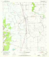
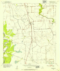
- 305370
- Scale
- 1:24,000
- Version Date
- 01/01/1952
- Regions
- TX
- Countries
- USA
- Media
- Paper
- Format
- Flat
Additional Details
- Description
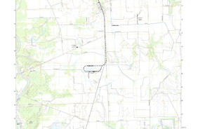
- WADSWORTH, TX HISTORICAL MAP GEOPDF 7.5X7.5 GRID 24000-SCALE 1952
- Survey Date
- 1952
- Print Date
- 1968
- Height In Inches
- 26.900
- Length In Inches
- 23.000
- Boundary Type
- Quadrangle
- Pieces
- 1
Related Items
WADSWORTH, TX HISTORICAL MAP GEOPDF 7.5X7.5 GRID 24000-SCALE 1952