
- Added WEST PENSACOLA, FL-AL to cart. View cart.
- Added BLUE CREEK MOUNTAIN, CA to cart. View cart.
- Added GILMORE, AL to cart. View cart.
- Added MOSCOW EAST, ID to cart. View cart.
- Added CHIMNEY CREEK, MT to cart. View cart.
- Added CHIMNEY BUTTE, MT to cart. View cart.
- Added CLAYSVILLE, KY to cart. View cart.
- Added ROGERS LAKE SOUTH, CA HISTORICAL MAP GEO to cart. View cart.
- Added ANCRAM, NY to cart. View cart.
- Added VILLA CREEK, CA HISTORICAL MAP GEOPDF 7. to cart. View cart.
- Added POLK CREEK MOUNTAIN, AR to cart. View cart.
- Added HYDROLOGIC CONDITIONS OF LOUISVILLE, KY to cart. View cart.
- Added CROOKS MEADOW, NV-CA HISTORICAL MAP GEOP to cart. View cart.
- Added GRIST MOUNTAIN, NC to cart. View cart.
- Added VENTURA, CA to cart. View cart.
- Added FORT SILL, OK HISTORICAL MAP GEOPDF 7.5X to cart. View cart.


Product Details
- Product Number
- 302925
- Scale
- 1:24,000
- Version Date
- 01/01/1970
- Regions
- OK
- Countries
- USA
- Media
- Paper
- Format
- Flat
Additional Details
- Description
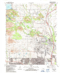
- FORT SILL, OK HISTORICAL MAP GEOPDF 7.5X7.5 GRID 24000-SCALE 1956
- Survey Date
- 1956
- Print Date
- 1971
- Height In Inches
- 27.400
- Length In Inches
- 22.500
- Boundary Type
- Quadrangle
- Pieces
- 1
Related Items
FORT SILL, OK HISTORICAL MAP GEOPDF 7.5X7.5 GRID 24000-SCALE 1991