
Added IRON RIVER, MI-WI HISTORICAL MAP GEOPDF to cart. View cart.

Product Details
- Product Number
- 875357
- Scale
- 1:100,000
- Version Date
- 01/01/1989
- Media
- Paper
- Format
- Flat
- Digital Reproduction
- Yes
Additional Details
- Description
- ROCHESTER, MN-WI HISTORICAL MAP GEOPDF 30X60 GRID 100000-SCALE 1989
- Survey Date
- 1989
- Print Date
- 1989
- Boundary Type
- Quadrangle
- Pieces
- 1
Related Items
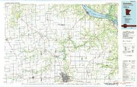
ROCHESTER, MN-WI HISTORICAL MAP GEOPDF 30X60 GRID 100000-SCALE 1985
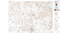
IRON RIVER, MI-WI HISTORICAL MAP GEOPDF 30X60 GRID 100000-SCALE 1989
BOSTON, MA-RI-CT HISTORICAL MAP GEOPDF 30X60 GRID 100000-SCALE 1989