- Added CLARKSBURG, TN to cart. View cart.
- Added TIMBALIER ISLAND, LA to cart. View cart.
- Added WESTPORT, WA to cart. View cart.
- Added PAWNEE ROCK, KS to cart. View cart.
- Added SUFFOLK, VA HISTORICAL MAP GEOPDF 7.5X7. to cart. View cart.
- Added WOOD LAKE NE, NE HISTORICAL MAP GEOPDF 7 to cart. View cart.
- Added OCEAN BAY, SC HISTORICAL MAP GEOPDF 7.5X to cart. View cart.
- Added PAWNEE MOUND, KS to cart. View cart.
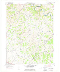
- Added SHADY NOOK, KY HISTORICAL MAP GEOPDF 7.5 to cart. View cart.


Product Details
- Product Number
- 263875
- Scale
- 1:24,000
- Version Date
- 01/01/1952
- Regions
- KY
- Countries
- USA
- Media
- Paper
- Format
- Flat
Additional Details
- Description
- SHADY NOOK, KY HISTORICAL MAP GEOPDF 7.5X7.5 GRID 24000-SCALE 1952
- Survey Date
- 1952
- Print Date
- 1954
- Height In Inches
- 27.400
- Length In Inches
- 23.000
- Boundary Type
- Quadrangle
- Pieces
- 1
Related Items

SHADY NOOK, KY HISTORICAL MAP GEOPDF 7.5X7.5 GRID 24000-SCALE 1952