- Added MOOSE RIDGE, ID to cart. View cart.
- Added TRIPOLI, IA HISTORICAL MAP GEOPDF 7.5X7. to cart. View cart.
- Added STORY CITY, IA to cart. View cart.
- Added PARKERSBURG, IA to cart. View cart.
- Added BEAR PARK EAST, ID to cart. View cart.
- Added LINEVILLE, IA-MO to cart. View cart.
- Added BROWN CREEK RIDGE, ID to cart. View cart.
- Added BRADBURY FLAT, ID HISTORICAL MAP GEOPDF to cart. View cart.
- Added MIDNIGHT MOUNTAIN, ID HISTORICAL MAP GEO to cart. View cart.
- Added CLAYTON, ID to cart. View cart.
- Added AMERICAN FALLS SW, ID to cart. View cart.
- Added CACHE PEAK, ID to cart. View cart.
- Added BOTTLENECK LAKE, ID HISTORICAL MAP GEOPD to cart. View cart.
- Added BIG CEDAR, ID HISTORICAL MAP GEOPDF 7.5X to cart. View cart.
- Added SCHALLER NORTH, IA HISTORICAL MAP GEOPDF to cart. View cart.


Product Details
- Product Number
- 861747
- Scale
- 1:24,000
- Version Date
- 01/01/1979
- Regions
- IA
- Countries
- USA
- Media
- Paper
- Format
- Flat
- Digital Reproduction
- Yes
Additional Details
- Description
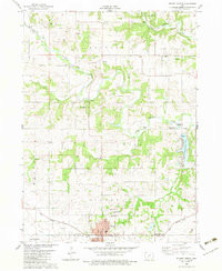
- SCHALLER NORTH, IA HISTORICAL MAP GEOPDF 7.5X7.5 GRID 24000-SCALE 1979
- Survey Date
- 1979
- Print Date
- 1979
- Boundary Type
- Quadrangle
- Pieces
- 1
Related Items

STUART NORTH, IA HISTORICAL MAP GEOPDF 7.5X7.5 GRID 24000-SCALE 1982