
- Added CLARE, IA to cart. View cart.
- Added WHITE BIRD HILL, ID to cart. View cart.
- Added HAMPTON SOUTH, IA to cart. View cart.
- Added SYLVANIA SOUTH, GA to cart. View cart.
- Added AVOCA, IA HISTORICAL MAP GEOPDF 7.5X7.5 to cart. View cart.
- Added HUMBOLDT, IA to cart. View cart.
- Added PUUPOHAKULOA, HI HISTORICAL MAP GEOPDF 7 to cart. View cart.
- Added CLEGHORN, IA HISTORICAL MAP GEOPDF 7.5X7 to cart. View cart.
- Added CLARION SW, IA HISTORICAL MAP GEOPDF 7.5 to cart. View cart.
- Added GRAY, IA HISTORICAL MAP GEOPDF 7.5X7.5 G to cart. View cart.
- Added BUTLER CENTER, IA HISTORICAL MAP GEOPDF to cart. View cart.
- Added WINDER NORTH, GA to cart. View cart.
- Added BROOKLYN, IA to cart. View cart.
- Added PUUHOU, HI HISTORICAL MAP GEOPDF 7.5X7.5 to cart. View cart.
- Added BODE, IA HISTORICAL MAP GEOPDF 7.5X7.5 G to cart. View cart.
- Added CLIO, IA to cart. View cart.
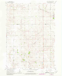
- Added CONRAD WEST, IA HISTORICAL MAP GEOPDF 7. to cart. View cart.


Product Details
- Product Number
- 265059
- Scale
- 1:24,000
- Version Date
- 01/01/1960
- Regions
- IA
- Countries
- USA
- Media
- Paper
- Format
- Flat
Additional Details
- Description
- CONRAD WEST, IA HISTORICAL MAP GEOPDF 7.5X7.5 GRID 24000-SCALE 1960
- Survey Date
- 1960
- Print Date
- 1966
- Height In Inches
- 26.900
- Length In Inches
- 22.100
- Boundary Type
- Quadrangle
- Pieces
- 1
Related Items


CONRAD WEST, IA HISTORICAL MAP GEOPDF 7.5X7.5 GRID 24000-SCALE 1960