
Added PORT BYRON, IL-IA HISTORICAL MAP GEOPDF to cart. View cart.

Product Details
- Product Number
- 859138
- Scale
- 1:24,000
- Version Date
- 01/01/1991
- Media
- Paper
- Format
- Flat
- Digital Reproduction
- Yes
Additional Details
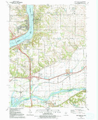
- Description
- PORT BYRON, IL-IA HISTORICAL MAP GEOPDF 7.5X7.5 GRID 24000-SCALE 1991
- Survey Date
- 1991
- Print Date
- 1992
- Boundary Type
- Quadrangle
- Pieces
- 1
Related Items
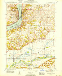
PORT BYRON, IL-IA HISTORICAL MAP GEOPDF 7.5X7.5 GRID 24000-SCALE 1950
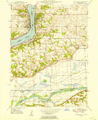
PORT BYRON, IL-IA HISTORICAL MAP GEOPDF 7.5X7.5 GRID 24000-SCALE 1949
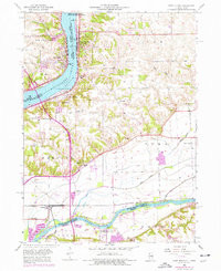
PORT BYRON, IL-IA HISTORICAL MAP GEOPDF 7.5X7.5 GRID 24000-SCALE 1953