
Added MEREDOSIA, IL HISTORICAL MAP GEOPDF 30X6 to cart. View cart.

Product Details
- Product Number
- 69952
- Scale
- 1:100,000
- Alternate ID
- TMO1546
- ISBN
- 978-0-607-28725-7
- Version Date
- 01/01/1985
- Regions
- IL, MO
- Countries
- USA
- Media
- Paper
- Format
- Flat
- Digital Reproduction
- Yes
Additional Details
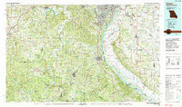
- Description
- FESTUS, MO-IL HISTORICAL MAP GEOPDF 30X60 GRID 100000-SCALE 1985
- Survey Date
- 1985
- Print Date
- 1987
- Height In Inches
- 24.100
- Length In Inches
- 40.900
- Boundary Type
- Quadrangle
- Two Sided
- No
- Pieces
- 1
- Languages
- English
Related Items

CHAMPAIGN, IL HISTORICAL MAP GEOPDF 30X60 GRID 100000-SCALE 1985

MEREDOSIA, IL HISTORICAL MAP GEOPDF 30X60 GRID 100000-SCALE 1985
CONCORDIA, KS HISTORICAL MAP GEOPDF 30X60 GRID 100000-SCALE 1985