
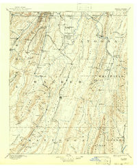

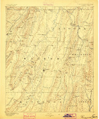
Product Details
- Product Number
- 854011
- Scale
- 1:125,000
- Version Date
- 01/01/1892
- Media
- Paper
- Format
- Flat
- Digital Reproduction
- Yes
Additional Details
- Description
- RINGGOLD, GA-TN HISTORICAL MAP GEOPDF 30X30 GRID 125000-SCALE 1892
- Survey Date
- 1892
- Print Date
- 1942
- Boundary Type
- Quadrangle
- Pieces
- 1
Related Items
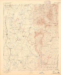
RINGGOLD, GA-TN HISTORICAL MAP GEOPDF 30X30 GRID 125000-SCALE 1886

TALLAPOOSA, GA-AL HISTORICAL MAP GEOPDF 30X30 GRID 125000-SCALE 1892
DALTON, GA-TN HISTORICAL MAP GEOPDF 30X30 GRID 125000-SCALE 1892