

Product Details
- Product Number
- 838778
- Scale
- 1:24,000
- Version Date
- 01/01/1947
- Media
- Paper
- Format
- Flat
- Digital Reproduction
- Yes
Additional Details
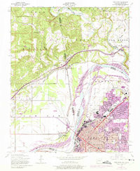
- Description
- FORT SMITH, AR-OK HISTORICAL MAP GEOPDF 7.5X7.5 GRID 24000-SCALE 1947
- Survey Date
- 1947
- Print Date
- 1974
- Boundary Type
- Quadrangle
- Pieces
- 1
Related Items
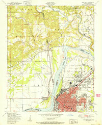
FORT SMITH, AR-OK HISTORICAL MAP GEOPDF 7.5X7.5 GRID 24000-SCALE 1951
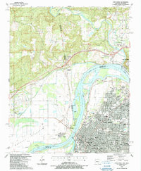
FORT SMITH, AR-OK HISTORICAL MAP GEOPDF 7.5X7.5 GRID 24000-SCALE 1987
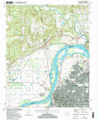
FORT SMITH, AR-OK HISTORICAL MAP GEOPDF 7.5X7.5 GRID 24000-SCALE 1997