
- Added UGASHIK A-3, AK to cart. View cart.
- Added PALMETTO, AL to cart. View cart.
- Added BOWLIN RANCH, NM to cart. View cart.
- Added TAJIGUAS, CA to cart. View cart.
- Added ARROWHEAD BUTTE, AZ HISTORICAL MAP GEOPD to cart. View cart.
- Added LINDSAY, CA to cart. View cart.
- Added BISHOP RANCH, NM to cart. View cart.
- Added MICA MOUNTAIN, WA to cart. View cart.
- Added BANNACK-GRAYLING AREA, GEOLOG, MT to cart. View cart.
- Added ASHURST LAKE, AZ HISTORICAL MAP GEOPDF 7 to cart. View cart.


Product Details
- Product Number
- 40519
- Scale
- 1:24,000
- Alternate ID
- TAZ0068
- ISBN
- 978-0-607-06258-8
- Version Date
- 01/01/1980
- Regions
- AZ
- Countries
- USA
- Media
- Paper
- Format
- Flat
- Digital Reproduction
- Yes
Additional Details
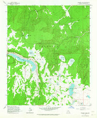
- Description
- ASHURST LAKE, AZ HISTORICAL MAP GEOPDF 7.5X7.5 GRID 24000-SCALE 1962
- Survey Date
- 1962
- Print Date
- 1984
- Height In Inches
- 26.900
- Length In Inches
- 22.000
- Boundary Type
- Quadrangle
- Two Sided
- No
- Pieces
- 1
- Languages
- English
Related Items

ASHURST LAKE, AZ HISTORICAL MAP GEOPDF 7.5X7.5 GRID 24000-SCALE 1962