
- Added CAMERON, WV-PA HISTORICAL MAP GEOPDF 7.5 to cart. View cart.
- Added RENA LARA, MS-AR to cart. View cart.
- Added LAKE CRESCENT, WA HISTORICAL MAP GEOPDF to cart. View cart.
- Added DELTA, UT to cart. View cart.
- Added BUCKHORN PEAK, CA HISTORICAL MAP GEOPDF to cart. View cart.
- Added TYLER MOUNTAIN, CO to cart. View cart.
- Added SOUTH FORT SMITH, AR-OK HISTORICAL MAP G to cart. View cart.
- Added LAGUNA BEACH, CA to cart. View cart.
- Added TARPLEY PASS, TX HISTORICAL MAP GEOPDF 7 to cart. View cart.
- Added FORT SMITH, AR-OK HISTORICAL MAP GEOPDF to cart. View cart.
- Added REDWOOD, VA to cart. View cart.
- Added ANNANDALE, VA to cart. View cart.
- Added WOLF HOLE MOUNTAIN WEST, AZ to cart. View cart.
- Added LONG ISLAND, TX to cart. View cart.
- Added NORTONVILLE, KY to cart. View cart.
- Added CAMP GARCIA, TX to cart. View cart.
- Added COLVILLE, WA HISTORICAL MAP GEOPDF 7.5X7 to cart. View cart.
- Added JOPPA, IL-KY to cart. View cart.
- Added CLARKSVILLE, FL to cart. View cart.
- Added OTSEGO, OH to cart. View cart.
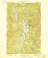
- Added CHEWELAH, WA HISTORICAL MAP GEOPDF 30X30 to cart. View cart.
- Added CHEWELAH, WA to cart. View cart.

Product Details
- Product Number
- 924535
- Scale
- 1:125,000
- Version Date
- 01/01/1930
- Regions
- WA
- Countries
- USA
- Media
- Paper
- Format
- Flat
- Digital Reproduction
- Yes
Additional Details
- Description
- CHEWELAH, WA HISTORICAL MAP GEOPDF 30X30 GRID 125000-SCALE 1930
- Survey Date
- 1930
- Print Date
- 1930
- Boundary Type
- Quadrangle
- Pieces
- 1
Related Items
CHEWELAH, WA HISTORICAL MAP GEOPDF 7.5X7.5 GRID 24000-SCALE 1964