- Added WEST OF PALO VERDE PEAK, CA to cart. View cart.
- Added HORSE PEAK, CA to cart. View cart.
- Added COSTILLA COUNTY SHEET 2, CO to cart. View cart.
- Added CORRAL PEAKS, CO to cart. View cart.
- Added JOSHUA FLATS, CA to cart. View cart.
- Added NINEMILE WASH, CA to cart. View cart.
- Added CAMATTA CANYON, CA HISTORICAL MAP GEOPDF to cart. View cart.
- Added CEDARVILLE, CA to cart. View cart.
- Added OLD WOMAN SPRINGS, CA to cart. View cart.
- Added TRINITY MOUNTAIN, CA HISTORICAL MAP GEOP to cart. View cart.
- Added MOUNT BIDWELL, CA-OR HISTORICAL MAP GEOP to cart. View cart.
- Added GALENA CANYON, CA to cart. View cart.
- Added CALISTOGA, CA to cart. View cart.
- Added ETNA, CA to cart. View cart.
- Added CEMENT MOUNTAIN, CO to cart. View cart.
- Added HOMEWOOD CANYON, CA to cart. View cart.
- Added PAT KEYES CANYON, CA to cart. View cart.
- Added PRINGLE FLAT, OR to cart. View cart.
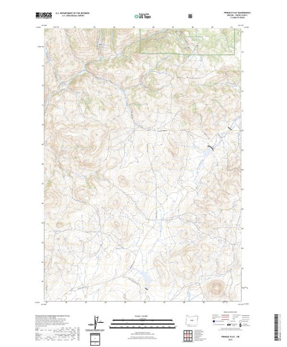

Product Details
- Product Number
- 824091
- Scale
- 1:24,000
- Version Date
- 01/01/2023
- Regions
- OR
- Countries
- USA
- Media
- Paper
- Format
- Flat
- Digital Reproduction
- Yes
Additional Details
- Description
- PRINGLE FLAT, OR TNM GEOSPATIAL PDF 7.5X7.5 GRID 24000
- Survey Date
- 2023
- Print Date
- 2024
- Height In Inches
- 29.000
- Length In Inches
- 24.000
- Boundary Type
- Quadrangle
- Pieces
- 1
Related Items